
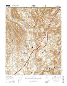
~ Estler Peak AZ topo map, 1:24000 scale, 7.5 X 7.5 Minute, 2014
Estler Peak, Arizona, USGS topographic map dated 2014.
Includes geographic coordinates (latitude and longitude). This topographic map is suitable for hiking, camping, and exploring, or framing it as a wall map.
Printed on-demand using high resolution imagery, on heavy weight and acid free paper, or alternatively on a variety of synthetic materials.
Topos available on paper, Waterproof, Poly, or Tyvek. Usually shipping rolled, unless combined with other folded maps in one order.
- Product Number: USGS-7236863
- Free digital map download (high-resolution, GeoPDF): Estler Peak, Arizona (file size: 25 MB)
- Map Size: please refer to the dimensions of the GeoPDF map above
- Weight (paper map): ca. 55 grams
- Map Type: POD USGS Topographic Map
- Map Series: US Topo
- Map Verison: Current
- Cell ID: 14585
- Datum: North American Datum of 1983
- Map Projection: Transverse Mercator
- Map Cell Name: Estler Peak
- Grid size: 7.5 X 7.5 Minute
- Date on map: 2014
- Map Scale: 1:24000
- Geographical region: Arizona, United States
Neighboring Maps:
All neighboring USGS topo maps are available for sale online at a variety of scales.
Spatial coverage:
Topo map Estler Peak, Arizona, covers the geographical area associated the following places:
- Cienega Creek - East Pasture Tank - Cedar Tank - Old East Side Tank - Cedar Spring - Black Butte Tank - V Bar Tank - Antelope Tank - Quarter Circle V Bar Ranch - Metate Tank - Osborne Well Number Two - Severty Nine Tank - Racetrack Wash - Hooker Tank - Ormes Substation - Heifer Pasture Well - Burro Tank - Wingfield Tank - Yellow Jacket Creek - Johnson Wash - Horner Gulch - The Orme School - Black Canyon Well - Fence Tank - Hackberry Wash - Estler Peak - Upper Government Tank - Dugas Interchange - Government Spring Gulch - Long Draw Well - Yellow Jacket Gulch - Osborne Spring - Ash Creek Well - Sterling Tank - Hance Mesa Tank - Sheep Spring - Orme School - Government Spring - Cattleguard Well - Osborne Spring Wash - Long Draw - Orme School Airport (historical) - Cienega Tank - Cienega Tank - Osborne Well - Brown Spring - Long Ridge Tank
- Map Area ID: AREA34.534.375-112.125-112
- Northwest corner Lat/Long code: USGSNW34.5-112.125
- Northeast corner Lat/Long code: USGSNE34.5-112
- Southwest corner Lat/Long code: USGSSW34.375-112.125
- Southeast corner Lat/Long code: USGSSE34.375-112
- Northern map edge Latitude: 34.5
- Southern map edge Latitude: 34.375
- Western map edge Longitude: -112.125
- Eastern map edge Longitude: -112


