
~ Esperanza Mill AZ topo map, 1:24000 scale, 7.5 X 7.5 Minute, 2014
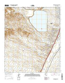
Esperanza Mill, Arizona, USGS topographic map dated 2014.
Includes geographic coordinates (latitude and longitude). This topographic map is suitable for hiking, camping, and exploring, or framing it as a wall map.
Printed on-demand using high resolution imagery, on heavy weight and acid free paper, or alternatively on a variety of synthetic materials.
Topos available on paper, Waterproof, Poly, or Tyvek. Usually shipping rolled, unless combined with other folded maps in one order.
- Product Number: USGS-7236861
- Free digital map download (high-resolution, GeoPDF): Esperanza Mill, Arizona (file size: 25 MB)
- Map Size: please refer to the dimensions of the GeoPDF map above
- Weight (paper map): ca. 55 grams
- Map Type: POD USGS Topographic Map
- Map Series: US Topo
- Map Verison: Current
- Cell ID: 14551
- Datum: North American Datum of 1983
- Map Projection: Transverse Mercator
- Map Cell Name: Esperanza Mill
- Grid size: 7.5 X 7.5 Minute
- Date on map: 2014
- Map Scale: 1:24000
- Geographical region: Arizona, United States
Neighboring Maps:
All neighboring USGS topo maps are available for sale online at a variety of scales.
Spatial coverage:
Topo map Esperanza Mill, Arizona, covers the geographical area associated the following places:
- Gemelo Tank - Esperanza Well - Desert Hills Golf Club of Green Valley - Green Valley Census Designated Place - Canoa Railroad Station - Wino Tank - Vally Presbyterian Church - Tinaja Wash - Canoa Interchange - Escondido Wash - Amargosa Wash - Sierrita Mill - Roades Ranch (historical) - Duval Leach Flood Dam Number One - White Iron Canyon - New Tank - Canoa Ranch Golf Club - Sierrita Tailings Dam - Desert Hills Golf Course - Esperanza Tank - Esperanza Wash - Wire Corral Tank - Hollywood Tank - Desert Hills Lutheran Church - Agua Caliente Canyon - Madera Canyon Wash - San Ignacio Golf Club - Demetrie Wash - Duval Lake - Salcedo Tank - Demetrie Well - KEZG-FM (Green Valley) - Green Valley Fire Department - Canoa Ranch - Salcedo Well - Gordo Tank - Ball Tank - Esperanza Mill
- Map Area ID: AREA31.87531.75-111.125-111
- Northwest corner Lat/Long code: USGSNW31.875-111.125
- Northeast corner Lat/Long code: USGSNE31.875-111
- Southwest corner Lat/Long code: USGSSW31.75-111.125
- Southeast corner Lat/Long code: USGSSE31.75-111
- Northern map edge Latitude: 31.875
- Southern map edge Latitude: 31.75
- Western map edge Longitude: -111.125
- Eastern map edge Longitude: -111


