
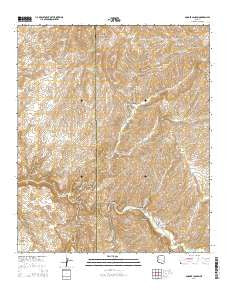
~ Booger Canyon AZ topo map, 1:24000 scale, 7.5 X 7.5 Minute, 2014
Booger Canyon, Arizona, USGS topographic map dated 2014.
Includes geographic coordinates (latitude and longitude). This topographic map is suitable for hiking, camping, and exploring, or framing it as a wall map.
Printed on-demand using high resolution imagery, on heavy weight and acid free paper, or alternatively on a variety of synthetic materials.
Topos available on paper, Waterproof, Poly, or Tyvek. Usually shipping rolled, unless combined with other folded maps in one order.
- Product Number: USGS-7236279
- Free digital map download (high-resolution, GeoPDF): Booger Canyon, Arizona (file size: 30 MB)
- Map Size: please refer to the dimensions of the GeoPDF map above
- Weight (paper map): ca. 55 grams
- Map Type: POD USGS Topographic Map
- Map Series: US Topo
- Map Verison: Current
- Cell ID: 4837
- Datum: North American Datum of 1983
- Map Projection: Transverse Mercator
- Map Cell Name: Booger Canyon
- Grid size: 7.5 X 7.5 Minute
- Date on map: 2014
- Map Scale: 1:24000
- Geographical region: Arizona, United States
Neighboring Maps:
All neighboring USGS topo maps are available for sale online at a variety of scales.
Spatial coverage:
Topo map Booger Canyon, Arizona, covers the geographical area associated the following places:
- Ash Creek Dam - Lookout Mountain - Sand Wash - Horse Canyon - Double Tank - Cottonwood Spring - Aravaipa School - Chet Tank - Jacks Tank - Aravaipa Canyon Primitive Area - The Chimney - Anderson Spring - Black Canyon Spring - Salazar Cemetery - Paisano Canyon - Telegraph Wash - Aravaipa Canyon Wilderness - Oak Spring - Bear Canyon - Wire Corral Draw - Parsons Canyon - Deer Creek - Turkey Creek - Juniper Spring - Dirt Tank - Lone Cedar Mesa - Martinez Canyon - Arizona Gulch - Booger Canyon - Hell Hole Valley - John Spring - Stone Cabin Canyon - Aravaipa Canyon Primitive Area East Entrance - McKinney Spring - Woodrows Tank - Big Tank - Hell Hole - Black Canyon - Maroga Canyon - Cement Tank - Hell Hole
- Map Area ID: AREA3332.875-110.5-110.375
- Northwest corner Lat/Long code: USGSNW33-110.5
- Northeast corner Lat/Long code: USGSNE33-110.375
- Southwest corner Lat/Long code: USGSSW32.875-110.5
- Southeast corner Lat/Long code: USGSSE32.875-110.375
- Northern map edge Latitude: 33
- Southern map edge Latitude: 32.875
- Western map edge Longitude: -110.5
- Eastern map edge Longitude: -110.375


