
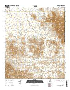
~ Cerro Colorado AZ topo map, 1:24000 scale, 7.5 X 7.5 Minute, 2014
Cerro Colorado, Arizona, USGS topographic map dated 2014.
Includes geographic coordinates (latitude and longitude). This topographic map is suitable for hiking, camping, and exploring, or framing it as a wall map.
Printed on-demand using high resolution imagery, on heavy weight and acid free paper, or alternatively on a variety of synthetic materials.
Topos available on paper, Waterproof, Poly, or Tyvek. Usually shipping rolled, unless combined with other folded maps in one order.
- Product Number: USGS-7236111
- Free digital map download (high-resolution, GeoPDF): Cerro Colorado, Arizona (file size: 28 MB)
- Map Size: please refer to the dimensions of the GeoPDF map above
- Weight (paper map): ca. 55 grams
- Map Type: POD USGS Topographic Map
- Map Series: US Topo
- Map Verison: Current
- Cell ID: 8009
- Datum: North American Datum of 1983
- Map Projection: Transverse Mercator
- Map Cell Name: Cerro Colorado
- Grid size: 7.5 X 7.5 Minute
- Date on map: 2014
- Map Scale: 1:24000
- Geographical region: Arizona, United States
Neighboring Maps:
All neighboring USGS topo maps are available for sale online at a variety of scales.
Spatial coverage:
Topo map Cerro Colorado, Arizona, covers the geographical area associated the following places:
- Cerro Colorado - Shirley Well - Colorado Clark Mine - Arivaca King Mine - Cerro Colorado Wash - Silver Hill - Black Princess Mine - Mitchell Well - Pesqueira Wash - Julia Tank - Good Enough Mine - Amado Well - Cerro Colorado Tank - Golden Star Mine - Rincon Tank - Placer Tank - Liberty Mine - Cerro Colorado Mine - Burro Tank - Cerro Colorado Mountains - Silver Shield Mine - Montano Ranch - Charles Mine - New Colorado Mine - Rancho Seco - Calera Wash - Rancho Seco Tank - Saucito Spring - Silver Hill Mine - Silver Coin Mine - Diving Board Tanks - Mary G Mine - Heintzelman Mine - Durazno Canyon - Square Tank - Oros Well - Fernstrom Tank - Cradle Tank
- Map Area ID: AREA31.7531.625-111.375-111.25
- Northwest corner Lat/Long code: USGSNW31.75-111.375
- Northeast corner Lat/Long code: USGSNE31.75-111.25
- Southwest corner Lat/Long code: USGSSW31.625-111.375
- Southeast corner Lat/Long code: USGSSE31.625-111.25
- Northern map edge Latitude: 31.75
- Southern map edge Latitude: 31.625
- Western map edge Longitude: -111.375
- Eastern map edge Longitude: -111.25


