
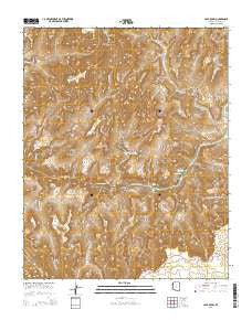
~ Cape Royal AZ topo map, 1:24000 scale, 7.5 X 7.5 Minute, 2014
Cape Royal, Arizona, USGS topographic map dated 2014.
Includes geographic coordinates (latitude and longitude). This topographic map is suitable for hiking, camping, and exploring, or framing it as a wall map.
Printed on-demand using high resolution imagery, on heavy weight and acid free paper, or alternatively on a variety of synthetic materials.
Topos available on paper, Waterproof, Poly, or Tyvek. Usually shipping rolled, unless combined with other folded maps in one order.
- Product Number: USGS-7236047
- Free digital map download (high-resolution, GeoPDF): Cape Royal, Arizona (file size: 28 MB)
- Map Size: please refer to the dimensions of the GeoPDF map above
- Weight (paper map): ca. 55 grams
- Map Type: POD USGS Topographic Map
- Map Series: US Topo
- Map Verison: Current
- Cell ID: 7179
- Datum: North American Datum of 1983
- Map Projection: Transverse Mercator
- Map Cell Name: Cape Royal
- Grid size: 7.5 X 7.5 Minute
- Date on map: 2014
- Map Scale: 1:24000
- Geographical region: Arizona, United States
Neighboring Maps:
All neighboring USGS topo maps are available for sale online at a variety of scales.
Spatial coverage:
Topo map Cape Royal, Arizona, covers the geographical area associated the following places:
- Hall Butte - Red Canyon - Papago Creek - Krishna Shrine - Hance Rapids - Hollenback Point - Hance Creek - Newberry Butte - Cottonwood Creek - Angels Window - Seventy-Five Mile Rapids - Moran Point - Vishnu Creek - Angels Gate - Freya Castle - Solomon Temple - Seventyfive Mile Creek - Apollo Temple - O'Neill Spring (historical) - Hance Canyon - Ayer Point - Coronado Butte - Papago Point - Nevills Rapids - Wotans Throne - Grandview Trail - Escalante Creek - Sockdolager Rapids - Dunn Butte - Vishnu Temple - Mineral Canyon - Zuni Point - The Tabernacle - Cape Royal - Page Spring - Hance Trail - Sheba Temple - Asbestos Canyon - Horseshoe Mesa - Last Chance Mine - Rama Shrine - Venus Temple - Hance Mine
- Map Area ID: AREA36.12536-112-111.875
- Northwest corner Lat/Long code: USGSNW36.125-112
- Northeast corner Lat/Long code: USGSNE36.125-111.875
- Southwest corner Lat/Long code: USGSSW36-112
- Southeast corner Lat/Long code: USGSSE36-111.875
- Northern map edge Latitude: 36.125
- Southern map edge Latitude: 36
- Western map edge Longitude: -112
- Eastern map edge Longitude: -111.875


