
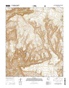
~ Cane Springs Mountain AZ topo map, 1:24000 scale, 7.5 X 7.5 Minute, 2014
Cane Springs Mountain, Arizona, USGS topographic map dated 2014.
Includes geographic coordinates (latitude and longitude). This topographic map is suitable for hiking, camping, and exploring, or framing it as a wall map.
Printed on-demand using high resolution imagery, on heavy weight and acid free paper, or alternatively on a variety of synthetic materials.
Topos available on paper, Waterproof, Poly, or Tyvek. Usually shipping rolled, unless combined with other folded maps in one order.
- Product Number: USGS-7236037
- Free digital map download (high-resolution, GeoPDF): Cane Springs Mountain, Arizona (file size: 27 MB)
- Map Size: please refer to the dimensions of the GeoPDF map above
- Weight (paper map): ca. 55 grams
- Map Type: POD USGS Topographic Map
- Map Series: US Topo
- Map Verison: Current
- Cell ID: 7042
- Datum: North American Datum of 1983
- Map Projection: Transverse Mercator
- Map Cell Name: Cane Springs Mountain
- Grid size: 7.5 X 7.5 Minute
- Date on map: 2014
- Map Scale: 1:24000
- Geographical region: Arizona, United States
Neighboring Maps:
All neighboring USGS topo maps are available for sale online at a variety of scales.
Spatial coverage:
Topo map Cane Springs Mountain, Arizona, covers the geographical area associated the following places:
- Polles Tank - Bull Tank - Greenhorn Canyon - Hogan Ridge - Grasshopper Tank - Camp Gulch - West Polles Tank - Road Ridge - Red Saddle Tank - Wilderness Tank - North Tank - Alder Tank - Bull Tank Mesa - Ross Tank - Rock Tank - Indian Spring Canyon - Twin Buttes - Saddle Ridge Tank - Saddle Ridge - Alder Ridge - L P Canyon - Whiterock Spring - Polles Mesa - Brushy Mesa - Trail Ridge - Hells Neck Ridge - Big Spring - Button Flat Tank - Cane Springs Mountain - Mogollon Rim - Mineral Hill Tank - Black Jack Tank - Indian Spring - Saddle Ridge Pasture - Saddle Corral - Hieroglyphic Canyon - U A Tank - Cane Springs Mountain Tank - Greenhorn Tank - Hardscrabble Mesa - Squaw Basin Tank - Plowbeam Tank - Cane Spring - Whiterock Mesa - Hieroglyphic Tanks - The Gorge - Middle Polles Tank - Cedar Bench - Taylor Tank - L P Spring - Bills Tank - Saddle Ridge Pasture Tank - Indian Spring Ridge - Bee Tree Tank
- Map Area ID: AREA34.37534.25-111.625-111.5
- Northwest corner Lat/Long code: USGSNW34.375-111.625
- Northeast corner Lat/Long code: USGSNE34.375-111.5
- Southwest corner Lat/Long code: USGSSW34.25-111.625
- Southeast corner Lat/Long code: USGSSE34.25-111.5
- Northern map edge Latitude: 34.375
- Southern map edge Latitude: 34.25
- Western map edge Longitude: -111.625
- Eastern map edge Longitude: -111.5


