
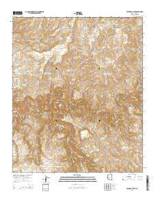
~ Beckers Butte AZ topo map, 1:24000 scale, 7.5 X 7.5 Minute, 2014
Beckers Butte, Arizona, USGS topographic map dated 2014.
Includes geographic coordinates (latitude and longitude). This topographic map is suitable for hiking, camping, and exploring, or framing it as a wall map.
Printed on-demand using high resolution imagery, on heavy weight and acid free paper, or alternatively on a variety of synthetic materials.
Topos available on paper, Waterproof, Poly, or Tyvek. Usually shipping rolled, unless combined with other folded maps in one order.
- Product Number: USGS-7235454
- Free digital map download (high-resolution, GeoPDF): Beckers Butte, Arizona (file size: 30 MB)
- Map Size: please refer to the dimensions of the GeoPDF map above
- Weight (paper map): ca. 55 grams
- Map Type: POD USGS Topographic Map
- Map Series: US Topo
- Map Verison: Current
- Cell ID: 2981
- Datum: North American Datum of 1983
- Map Projection: Transverse Mercator
- Map Cell Name: Beckers Butte
- Grid size: 7.5 X 7.5 Minute
- Date on map: 2014
- Map Scale: 1:24000
- Geographical region: Arizona, United States
Neighboring Maps:
All neighboring USGS topo maps are available for sale online at a variety of scales.
Spatial coverage:
Topo map Beckers Butte, Arizona, covers the geographical area associated the following places:
- Salt River Rim Tank - Beckers Butte - Well Canyon - Coyote Spring - Cup Tank - Black Mesa Tank - Tanks Canyon - Bear Grass Tank - Ike Clyde Tank - Lower Mud Tank - Golden Roll Dam - Walnut Canyon - Well Canyon Tank - Cedar Basin Dam - Frog Pond - Flying V Canyon - Gila Tank - Black Mesa - Bohee Tank - Beckers Butte Roadside Table - Cedar Basin Tank - Sawmill Creek - Horse Mesa Tank - Mud Spring - Brushy Canyon Tank Number Two - Lower Limestone Tank - Flying V Tank Number One - Cliffrose Tank - Pete Tank - I S Hole - Main Canyon Tank - Flying V Spring - Brushy Canyon Tank Number One - Sawmill Canyon - Chalk Tank - Flying V Well - Lower Horse Mesa Tank Number Two - Mud Tank - Beaver Creek - I S Hole Tanks - Golden Roll Tank - Mescal Pit Catchment Basin
- Map Area ID: AREA33.87533.75-110.5-110.375
- Northwest corner Lat/Long code: USGSNW33.875-110.5
- Northeast corner Lat/Long code: USGSNE33.875-110.375
- Southwest corner Lat/Long code: USGSSW33.75-110.5
- Southeast corner Lat/Long code: USGSSE33.75-110.375
- Northern map edge Latitude: 33.875
- Southern map edge Latitude: 33.75
- Western map edge Longitude: -110.5
- Eastern map edge Longitude: -110.375


