
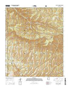
~ Baldy Bill Point AZ topo map, 1:24000 scale, 7.5 X 7.5 Minute, 2014
Baldy Bill Point, Arizona, USGS topographic map dated 2014.
Includes geographic coordinates (latitude and longitude). This topographic map is suitable for hiking, camping, and exploring, or framing it as a wall map.
Printed on-demand using high resolution imagery, on heavy weight and acid free paper, or alternatively on a variety of synthetic materials.
Topos available on paper, Waterproof, Poly, or Tyvek. Usually shipping rolled, unless combined with other folded maps in one order.
- Product Number: USGS-7235416
- Free digital map download (high-resolution, GeoPDF): Baldy Bill Point, Arizona (file size: 29 MB)
- Map Size: please refer to the dimensions of the GeoPDF map above
- Weight (paper map): ca. 55 grams
- Map Type: POD USGS Topographic Map
- Map Series: US Topo
- Map Verison: Current
- Cell ID: 2243
- Datum: North American Datum of 1983
- Map Projection: Transverse Mercator
- Map Cell Name: Baldy Bill Point
- Grid size: 7.5 X 7.5 Minute
- Date on map: 2014
- Map Scale: 1:24000
- Geographical region: Arizona, United States
Neighboring Maps:
All neighboring USGS topo maps are available for sale online at a variety of scales.
Spatial coverage:
Topo map Baldy Bill Point, Arizona, covers the geographical area associated the following places:
- Turkey Spring - McBride Corral - Upper Malay Tank - Cowhead Tank - Chitty Canyon Trail Thirty Four - Steer Pasture Tank - Bear Canyon - Double Cienega - Turkey Trap Tank - Reno Spring - Squirrel Spring - Chitty Falls - Upper McBride Spring - Dry Prong Trail Forty-five - Warren Canyon - Chitty Trap Corral - Bear Wallow Wilderness - Baldy Bill Point - Bear Spring - McBridge Canyon - Salt House Creek - Red Tail Tank - Cottonwood Tank - South Fork Bear Wallow Creek - Chitty Canyon - Squirrel Tank - North Fork Bear Wallow Creek - Warren Tank - Schell Canyon - Long Canyon Tank - Horse Pasture Spring - Reno Lookout - Upper Bear Spring - Maverick Spring - Horse Pasture Spring - Miller Spring - Chitty Creek Spring - Maverick Spring - Squirrel Canyon - Reno Lookout - Conklin Creek Campgrounds - Yellowjacket Corral - Sanders Corral - South Squirrel Spring - Malay Tank - Dogwood Spring - Malay Corral - Eagle Tank - Yellowjacket Spring - Saunders Cabin - Squirrel Canyon Tank
- Map Area ID: AREA33.62533.5-109.5-109.375
- Northwest corner Lat/Long code: USGSNW33.625-109.5
- Northeast corner Lat/Long code: USGSNE33.625-109.375
- Southwest corner Lat/Long code: USGSSW33.5-109.5
- Southeast corner Lat/Long code: USGSSE33.5-109.375
- Northern map edge Latitude: 33.625
- Southern map edge Latitude: 33.5
- Western map edge Longitude: -109.5
- Eastern map edge Longitude: -109.375


