
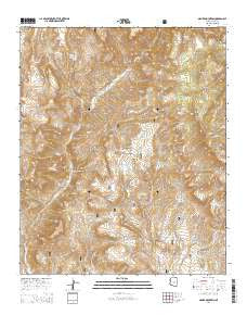
~ Armer Mountain AZ topo map, 1:24000 scale, 7.5 X 7.5 Minute, 2014
Armer Mountain, Arizona, USGS topographic map dated 2014.
Includes geographic coordinates (latitude and longitude). This topographic map is suitable for hiking, camping, and exploring, or framing it as a wall map.
Printed on-demand using high resolution imagery, on heavy weight and acid free paper, or alternatively on a variety of synthetic materials.
Topos available on paper, Waterproof, Poly, or Tyvek. Usually shipping rolled, unless combined with other folded maps in one order.
- Product Number: USGS-7235322
- Free digital map download (high-resolution, GeoPDF): Armer Mountain, Arizona (file size: 29 MB)
- Map Size: please refer to the dimensions of the GeoPDF map above
- Weight (paper map): ca. 55 grams
- Map Type: POD USGS Topographic Map
- Map Series: US Topo
- Map Verison: Current
- Cell ID: 1472
- Datum: North American Datum of 1983
- Map Projection: Transverse Mercator
- Map Cell Name: Armer Mountain
- Grid size: 7.5 X 7.5 Minute
- Date on map: 2014
- Map Scale: 1:24000
- Geographical region: Arizona, United States
Neighboring Maps:
All neighboring USGS topo maps are available for sale online at a variety of scales.
Spatial coverage:
Topo map Armer Mountain, Arizona, covers the geographical area associated the following places:
- Connor Canyon - Round Mountain - Big Cherry Creek - Little Cherry Creek - Chubb Mountain - Tucker Box - Hale Spring - Whiskey Tank - Dust Bowl Tank - Boyer Canyon - Tanner Peak - Thompson Mesa - Cherry Creek Spring - Dutchwoman Butte - Boyer Cabin - Boyer Ridge - Dutchwoman Tank - Cellar Creek - Reynolds Creek - Lower Thompson Mesa Tank - Salome Wilderness - The Jug - Boyer Trail One Hundred Fortyeight - Butte Tank - Hopkins Mountain - Center Ridge Tank - Tin House Spring - Upper Thompson Mesa Tank - Armer Mountain - Hopkins Spring
- Map Area ID: AREA33.87533.75-111.125-111
- Northwest corner Lat/Long code: USGSNW33.875-111.125
- Northeast corner Lat/Long code: USGSNE33.875-111
- Southwest corner Lat/Long code: USGSSW33.75-111.125
- Southeast corner Lat/Long code: USGSSE33.75-111
- Northern map edge Latitude: 33.875
- Southern map edge Latitude: 33.75
- Western map edge Longitude: -111.125
- Eastern map edge Longitude: -111


