
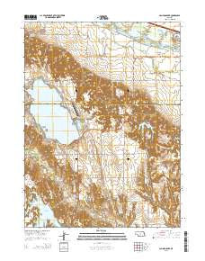
~ Johnson Lake NE topo map, 1:24000 scale, 7.5 X 7.5 Minute, 2014
Johnson Lake, Nebraska, USGS topographic map dated 2014.
Includes geographic coordinates (latitude and longitude). This topographic map is suitable for hiking, camping, and exploring, or framing it as a wall map.
Printed on-demand using high resolution imagery, on heavy weight and acid free paper, or alternatively on a variety of synthetic materials.
Topos available on paper, Waterproof, Poly, or Tyvek. Usually shipping rolled, unless combined with other folded maps in one order.
- Product Number: USGS-7161699
- Free digital map download (high-resolution, GeoPDF): Johnson Lake, Nebraska (file size: 26 MB)
- Map Size: please refer to the dimensions of the GeoPDF map above
- Weight (paper map): ca. 55 grams
- Map Type: POD USGS Topographic Map
- Map Series: US Topo
- Map Verison: Current
- Cell ID: 22697
- Datum: North American Datum of 1983
- Map Projection: Transverse Mercator
- Map Cell Name: Johnson Lake
- Grid size: 7.5 X 7.5 Minute
- Date on map: 2014
- Map Scale: 1:24000
- Geographical region: Nebraska, United States
Neighboring Maps:
All neighboring USGS topo maps are available for sale online at a variety of scales.
Spatial coverage:
Topo map Johnson Lake, Nebraska, covers the geographical area associated the following places:
- North Cove - Johnson Lake Airport - Earth Dam-Canal Mile 671 Dam - Bethel Public School - Chapel of the Lake - Bullhead Point - Bossung Lake - Elwood Reservoir Recreation Area - Kilby Point - Lauby Reservoir - Township of Platte - Johnson Lake - Knoeizer Dam - Main Area Campground - Inlet Area Campground - Sunset Shore Resort and RV Park - Mallard Cove - Northeast Bay - George E Johnson Historical Marker - Johnson Lake State Recreation Area - Bethel Election Precinct - Reverie Campground - Lakeside Country Club - School Number 15 - Johnson Lake Emergency Medical Services - Bass Bay - Perch Bay - Thompsons Resort - Elwood Dam - Lauby Dam - South Bay - Dry Bay - Elwood Reservoir - Phillips Lake State Recreation Area - Knoeizer Reservoir - North Shore - Earth Dam-Canal Mile 645 Dam - Platte Election Precinct - East Shore - JJs Marina and Campgrounds - North Inlet Area Campground - Earth Dam-Canal Mile 689 Dam - Mastens Camper Haven - Philips Lake - Mallard Beach - Earth Dam-Canal Mile 681 Dam - North Point - KRVN-FM (Lexington)
- Map Area ID: AREA40.7540.625-99.875-99.75
- Northwest corner Lat/Long code: USGSNW40.75-99.875
- Northeast corner Lat/Long code: USGSNE40.75-99.75
- Southwest corner Lat/Long code: USGSSW40.625-99.875
- Southeast corner Lat/Long code: USGSSE40.625-99.75
- Northern map edge Latitude: 40.75
- Southern map edge Latitude: 40.625
- Western map edge Longitude: -99.875
- Eastern map edge Longitude: -99.75


