
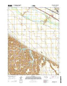
~ Gothenburg SE NE topo map, 1:24000 scale, 7.5 X 7.5 Minute, 2014
Gothenburg SE, Nebraska, USGS topographic map dated 2014.
Includes geographic coordinates (latitude and longitude). This topographic map is suitable for hiking, camping, and exploring, or framing it as a wall map.
Printed on-demand using high resolution imagery, on heavy weight and acid free paper, or alternatively on a variety of synthetic materials.
Topos available on paper, Waterproof, Poly, or Tyvek. Usually shipping rolled, unless combined with other folded maps in one order.
- Product Number: USGS-7161291
- Free digital map download (high-resolution, GeoPDF): Gothenburg SE, Nebraska (file size: 23 MB)
- Map Size: please refer to the dimensions of the GeoPDF map above
- Weight (paper map): ca. 55 grams
- Map Type: POD USGS Topographic Map
- Map Series: US Topo
- Map Verison: Current
- Cell ID: 17843
- Datum: North American Datum of 1983
- Map Projection: Transverse Mercator
- Map Cell Name: Gothenburg SE
- Grid size: 7.5 X 7.5 Minute
- Date on map: 2014
- Map Scale: 1:24000
- Geographical region: Nebraska, United States
Neighboring Maps:
All neighboring USGS topo maps are available for sale online at a variety of scales.
Spatial coverage:
Topo map Gothenburg SE, Nebraska, covers the geographical area associated the following places:
- East Willow Island State Wildlife Management Area - West Cozad State Wildlife Management Area - West Midway Lake - Pleasant View Cemetery - East Midway Lake - Earth Dam-Canal Mile 505 Dam - Earth Dam-Canal Mile 479 Dam - Earth Dam-Canal Mile 461 Dam - Earth Dam-Canal Mile 51 Dam - Orchard Alfalfa Canal - Midway Canyon - Earth Dam-Canal Mile 52 Dam - Midway Lake Recreational Grounds - Earth Dam-Canal Mile 515 Dam - Central Midway Lake - Earth Dam-Canal Mile 483 Dam - Earth Dam-Canal Mile 475 Dam - Buffalo Creek - Cozad Municipal Airport - KAMI-FM (Cozad) - Township of Fairview - West Cozad Lake - Camp Comeca
- Map Area ID: AREA40.87540.75-100.125-100
- Northwest corner Lat/Long code: USGSNW40.875-100.125
- Northeast corner Lat/Long code: USGSNE40.875-100
- Southwest corner Lat/Long code: USGSSW40.75-100.125
- Southeast corner Lat/Long code: USGSSE40.75-100
- Northern map edge Latitude: 40.875
- Southern map edge Latitude: 40.75
- Western map edge Longitude: -100.125
- Eastern map edge Longitude: -100


