
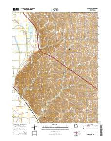
~ Kimsey Creek MO topo map, 1:24000 scale, 7.5 X 7.5 Minute, 2015
Kimsey Creek, Missouri, USGS topographic map dated 2015.
Includes geographic coordinates (latitude and longitude). This topographic map is suitable for hiking, camping, and exploring, or framing it as a wall map.
Printed on-demand using high resolution imagery, on heavy weight and acid free paper, or alternatively on a variety of synthetic materials.
Topos available on paper, Waterproof, Poly, or Tyvek. Usually shipping rolled, unless combined with other folded maps in one order.
- Product Number: USGS-7150695
- Free digital map download (high-resolution, GeoPDF): Kimsey Creek, Missouri (file size: 24 MB)
- Map Size: please refer to the dimensions of the GeoPDF map above
- Weight (paper map): ca. 55 grams
- Map Type: POD USGS Topographic Map
- Map Series: US Topo
- Map Verison: Current
- Cell ID: 23565
- Datum: North American Datum of 1983
- Map Projection: Transverse Mercator
- Map Cell Name: Kimsey Creek
- Grid size: 7.5 X 7.5 Minute
- Date on map: 2015
- Map Scale: 1:24000
- Geographical region: Missouri, United States
Neighboring Maps:
All neighboring USGS topo maps are available for sale online at a variety of scales.
Spatial coverage:
Topo map Kimsey Creek, Missouri, covers the geographical area associated the following places:
- Gordan Lake - Holt County - Lincoln School (historical) - Bailey Lake - Number 831 Dam - John Hall Lake - Squaw Creek National Wildlife Refuge - Marion Mendenhall Dam - Brush College Number One School (historical) - John Hall Dam - Boyd Cemetery - Swope Creek - Bailey Lake Dam - Oakland School (historical) - Shiloh School (historical) - Township of Benton - Bluff Pool - South Bethel Cemetery - Cannon Creek - Baldwin Cemetery - Blair Creek - Union School (historical) - Blan School (historical) - Benton Church - Eagle Pool - Cannon Creek Diversion - Kimsey Creek - Monticello School (historical) - Wilson Cemetery - Bagby School (historical) - Little Tarkio Creek - Benton School (historical) - Kimsey School (historical) - Roderick Cemetery - Gordan Lake Dam - Davis Creek
- Map Area ID: AREA40.12540-95.25-95.125
- Northwest corner Lat/Long code: USGSNW40.125-95.25
- Northeast corner Lat/Long code: USGSNE40.125-95.125
- Southwest corner Lat/Long code: USGSSW40-95.25
- Southeast corner Lat/Long code: USGSSE40-95.125
- Northern map edge Latitude: 40.125
- Southern map edge Latitude: 40
- Western map edge Longitude: -95.25
- Eastern map edge Longitude: -95.125


