
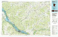
~ Winona MN topo map, 1:100000 scale, 30 X 60 Minute, Historical, 1985, updated 1985
Winona, Minnesota, USGS topographic map dated 1985.
Includes geographic coordinates (latitude and longitude). This topographic map is suitable for hiking, camping, and exploring, or framing it as a wall map.
Printed on-demand using high resolution imagery, on heavy weight and acid free paper, or alternatively on a variety of synthetic materials.
Topos available on paper, Waterproof, Poly, or Tyvek. Usually shipping rolled, unless combined with other folded maps in one order.
- Product Number: USGS-6088327
- Free digital map download (high-resolution, GeoPDF): Winona, Minnesota (file size: 17 MB)
- Map Size: please refer to the dimensions of the GeoPDF map above
- Weight (paper map): ca. 55 grams
- Map Type: POD USGS Topographic Map
- Map Series: HTMC
- Map Verison: Historical
- Cell ID: 68607
- Scan ID: 805933
- Imprint Year: 1985
- Woodland Tint: Yes
- Aerial Photo Year: 1981
- Edit Year: 1985
- Datum: NAD27
- Map Projection: Universal Transverse Mercator
- Planimetric: Yes
- Map published by United States Geological Survey
- Map Language: English
- Scanner Resolution: 508 dpi
- Map Cell Name: Winona
- Grid size: 30 X 60 Minute
- Date on map: 1985
- Map Scale: 1:100000
- Geographical region: Minnesota, United States
Neighboring Maps:
All neighboring USGS topo maps are available for sale online at a variety of scales.
Spatial coverage:
Topo map Winona, Minnesota, covers the geographical area associated the following places:
- Williamsburg (historical) - Hale - Centerville - Dodge - Dewey Corners - Hidden Valley Mobile Home Village - Stevenstown - North Creek - Altura - Bethany - West Prairie - Buffalo City - Anchorage (historical) - Oakridge - Marshland - Weaver - Kellogg - Goodview - Pigeon Falls - Montana - Pine Creek - Modena - Frenchville - Rollingstone - Whitman - Praag - Northfield - Cream - Urne - Alma - New City (historical) - West Newton - Tamarack - North Bend - Trempealeau - Mindoro - Elk Creek - Whitehall - Winona - Upper French Creek - Burr Oak - Bohri (historical) - Stockton - Waumandee - Fountain City - Crystal Spring - Independence - Pine Creek (historical) - Russell - Taylor - Coral City - Sugarloaf - Cochrane - Lookout - Franklin - Wrights Corners - Sechlerville - Disco - Hegg - Pleasantville - Hixton - Minnesota City - York - Iduna - East Winona - Tell - Lamoille - Bluff Siding - Galesville - Morningside Terrace - Arcadia - Homer - Beachs Corners - Blair - Gilmanton - Glencoe - Butman Corners - Herold - Rogneys (historical) - Czechville - Ettrick - Cortland (historical) - Minneiska - Council Bay - Chapultepee - Country Valley Mobile Home Park
- Map Area ID: AREA44.544-92-91
- Northwest corner Lat/Long code: USGSNW44.5-92
- Northeast corner Lat/Long code: USGSNE44.5-91
- Southwest corner Lat/Long code: USGSSW44-92
- Southeast corner Lat/Long code: USGSSE44-91
- Northern map edge Latitude: 44.5
- Southern map edge Latitude: 44
- Western map edge Longitude: -92
- Eastern map edge Longitude: -91


