
~ Bighorn Canyon CA topo map, 1:24000 scale, 7.5 X 7.5 Minute, Historical, 1972, updated 1994
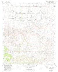
Bighorn Canyon, California, USGS topographic map dated 1972.
Includes geographic coordinates (latitude and longitude). This topographic map is suitable for hiking, camping, and exploring, or framing it as a wall map.
Printed on-demand using high resolution imagery, on heavy weight and acid free paper, or alternatively on a variety of synthetic materials.
Topos available on paper, Waterproof, Poly, or Tyvek. Usually shipping rolled, unless combined with other folded maps in one order.
- Product Number: USGS-6006572
- Free digital map download (high-resolution, GeoPDF): Bighorn Canyon, California (file size: 10 MB)
- Map Size: please refer to the dimensions of the GeoPDF map above
- Weight (paper map): ca. 55 grams
- Map Type: POD USGS Topographic Map
- Map Series: HTMC
- Map Verison: Historical
- Cell ID: 69354
- Scan ID: 302407
- Imprint Year: 1994
- Visual Version Number: 1
- Photo Inspection Year: 1989
- Aerial Photo Year: 1970
- Edit Year: 1994
- Field Check Year: 1972
- Datum: NAD27
- Map Projection: Lambert Conformal Conic
- Planimetric: Yes
- Map published by United States Geological Survey
- Map Language: English
- Scanner Resolution: 600 dpi
- Map Cell Name: Bighorn Canyon
- Grid size: 7.5 X 7.5 Minute
- Date on map: 1972
- Map Scale: 1:24000
- Geographical region: California, United States
Neighboring Maps:
All neighboring USGS topo maps are available for sale online at a variety of scales.
Spatial coverage:
Topo map Bighorn Canyon, California, covers the geographical area associated the following places:
- Saddlerock Spring - San Bernardino County Fire Department Station 43 Johnson - Valley Vista Airport - Bighorn Canyon - Rubber Drain Two - Rock Corral - Parson Ranch
- Map Area ID: AREA34.37534.25-116.625-116.5
- Northwest corner Lat/Long code: USGSNW34.375-116.625
- Northeast corner Lat/Long code: USGSNE34.375-116.5
- Southwest corner Lat/Long code: USGSSW34.25-116.625
- Southeast corner Lat/Long code: USGSSE34.25-116.5
- Northern map edge Latitude: 34.375
- Southern map edge Latitude: 34.25
- Western map edge Longitude: -116.625
- Eastern map edge Longitude: -116.5


