
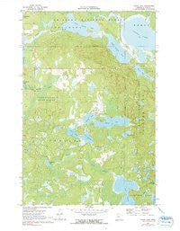
~ Laura Lake MN topo map, 1:24000 scale, 7.5 X 7.5 Minute, Historical, 1970, updated 1991
Laura Lake, Minnesota, USGS topographic map dated 1970.
Includes geographic coordinates (latitude and longitude). This topographic map is suitable for hiking, camping, and exploring, or framing it as a wall map.
Printed on-demand using high resolution imagery, on heavy weight and acid free paper, or alternatively on a variety of synthetic materials.
Topos available on paper, Waterproof, Poly, or Tyvek. Usually shipping rolled, unless combined with other folded maps in one order.
- Product Number: USGS-5996540
- Free digital map download (high-resolution, GeoPDF): Laura Lake, Minnesota (file size: 11 MB)
- Map Size: please refer to the dimensions of the GeoPDF map above
- Weight (paper map): ca. 55 grams
- Map Type: POD USGS Topographic Map
- Map Series: HTMC
- Map Verison: Historical
- Cell ID: 25084
- Scan ID: 805720
- Imprint Year: 1991
- Woodland Tint: Yes
- Photo Inspection Year: 1980
- Aerial Photo Year: 1968
- Field Check Year: 1970
- Datum: NAD27
- Map Projection: Polyconic
- Map published by United States Geological Survey
- Map Language: English
- Scanner Resolution: 508 dpi
- Map Cell Name: Laura Lake
- Grid size: 7.5 X 7.5 Minute
- Date on map: 1970
- Map Scale: 1:24000
- Geographical region: Minnesota, United States
Neighboring Maps:
All neighboring USGS topo maps are available for sale online at a variety of scales.
Spatial coverage:
Topo map Laura Lake, Minnesota, covers the geographical area associated the following places:
- Daggett Brook Reservoir - Snowball - Lake Twentysix - Little Bass Lake - Mitten Lake - Lake George - Daggett Brook Dam - Northby Creek - Snowball Post Office (historical) - Hoister Lake - Upper Trelipe Lake - Laura Brook - Minnesota Chippewa Trust Land - Cranberry Lake - O'Conner Lake - Lower Trelipe Lake - Safe Air Seaplane Base - Township of Trelipe - Trelipe Creek - Island Lake - Stevens Lake - Salem Lutheran Cemetery - Laura Lake
- Map Area ID: AREA4746.875-94.125-94
- Northwest corner Lat/Long code: USGSNW47-94.125
- Northeast corner Lat/Long code: USGSNE47-94
- Southwest corner Lat/Long code: USGSSW46.875-94.125
- Southeast corner Lat/Long code: USGSSE46.875-94
- Northern map edge Latitude: 47
- Southern map edge Latitude: 46.875
- Western map edge Longitude: -94.125
- Eastern map edge Longitude: -94


