
~ Wheaton MN topo map, 1:100000 scale, 30 X 60 Minute, Historical, 1985, updated 1985
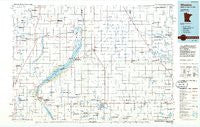
Wheaton, Minnesota, USGS topographic map dated 1985.
Includes geographic coordinates (latitude and longitude). This topographic map is suitable for hiking, camping, and exploring, or framing it as a wall map.
Printed on-demand using high resolution imagery, on heavy weight and acid free paper, or alternatively on a variety of synthetic materials.
Topos available on paper, Waterproof, Poly, or Tyvek. Usually shipping rolled, unless combined with other folded maps in one order.
- Product Number: USGS-5989570
- Free digital map download (high-resolution, GeoPDF): Wheaton, Minnesota (file size: 11 MB)
- Map Size: please refer to the dimensions of the GeoPDF map above
- Weight (paper map): ca. 55 grams
- Map Type: POD USGS Topographic Map
- Map Series: HTMC
- Map Verison: Historical
- Cell ID: 68576
- Scan ID: 805924
- Imprint Year: 1985
- Woodland Tint: Yes
- Aerial Photo Year: 1984
- Edit Year: 1985
- Datum: NAD27
- Map Projection: Universal Transverse Mercator
- Planimetric: Yes
- Map published by United States Geological Survey
- Map Language: English
- Scanner Resolution: 508 dpi
- Map Cell Name: Wheaton
- Grid size: 30 X 60 Minute
- Date on map: 1985
- Map Scale: 1:100000
- Geographical region: Minnesota, United States
Neighboring Maps:
All neighboring USGS topo maps are available for sale online at a variety of scales.
Spatial coverage:
Topo map Wheaton, Minnesota, covers the geographical area associated the following places:
- Peever Flats - Graceville - Chokio - White Rock - Rosholt - New Effington - Beardsley - Schultz Trailer Park - White Rock Colony - Boisberg - Diamond - Browns Valley - Barry - Donnelly - Peever - Alberta - Norcross - Victor - Charlesville - Dakomin - Herman - La Mars - Dumont - Collis - Johnson - Big Stone Colony - Blackmer - Wheaton - Bergs Mobile Home Park
- Map Area ID: AREA4645.5-97-96
- Northwest corner Lat/Long code: USGSNW46-97
- Northeast corner Lat/Long code: USGSNE46-96
- Southwest corner Lat/Long code: USGSSW45.5-97
- Southeast corner Lat/Long code: USGSSE45.5-96
- Northern map edge Latitude: 46
- Southern map edge Latitude: 45.5
- Western map edge Longitude: -97
- Eastern map edge Longitude: -96


