
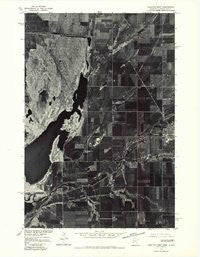
~ Wheaton West MN topo map, 1:24000 scale, 7.5 X 7.5 Minute, Historical, 1977, updated 1979
Wheaton West, Minnesota, USGS topographic map dated 1977.
Includes geographic coordinates (latitude and longitude). This topographic map is suitable for hiking, camping, and exploring, or framing it as a wall map.
Printed on-demand using high resolution imagery, on heavy weight and acid free paper, or alternatively on a variety of synthetic materials.
Topos available on paper, Waterproof, Poly, or Tyvek. Usually shipping rolled, unless combined with other folded maps in one order.
- Product Number: USGS-5989562
- Free digital map download (high-resolution, GeoPDF): Wheaton West, Minnesota (file size: 9 MB)
- Map Size: please refer to the dimensions of the GeoPDF map above
- Weight (paper map): ca. 55 grams
- Map Type: POD USGS Topographic Map
- Map Series: HTMC
- Map Verison: Historical
- Cell ID: 48542
- Scan ID: 805429
- Imprint Year: 1979
- Aerial Photo Year: 1977
- Datum: NAD27
- Map Projection: Lambert Conformal Conic
- Orthophoto: Quad
- Map published by United States Geological Survey
- Keywords: Nonstandard Press Run
- Map Language: English
- Scanner Resolution: 508 dpi
- Map Cell Name: Wheaton West
- Grid size: 7.5 X 7.5 Minute
- Date on map: 1977
- Map Scale: 1:24000
- Geographical region: Minnesota, United States
Neighboring Maps:
All neighboring USGS topo maps are available for sale online at a variety of scales.
Spatial coverage:
Topo map Wheaton West, Minnesota, covers the geographical area associated the following places:
- Nelson Cemetery - Wheaton Community Health Center - School Number 53 (historical) - Eighteenmile Creek - Mustinka River - School Number 47 (historical) - White Rock Dam - Wheaton High School - Sanford Wheaton Medical Center - Mud Lake - Calvary Worship Center - Wheaton Country Club - White Rock Dam State Wildlife Management Area - School Number 15 (historical) - Larsens Camp - Wheaton Municipal Airport - Plum Island - Big Slough - Saint John's Lutheran Church - Lincoln School (historical)
- Map Area ID: AREA45.87545.75-96.625-96.5
- Northwest corner Lat/Long code: USGSNW45.875-96.625
- Northeast corner Lat/Long code: USGSNE45.875-96.5
- Southwest corner Lat/Long code: USGSSW45.75-96.625
- Southeast corner Lat/Long code: USGSSE45.75-96.5
- Northern map edge Latitude: 45.875
- Southern map edge Latitude: 45.75
- Western map edge Longitude: -96.625
- Eastern map edge Longitude: -96.5


