
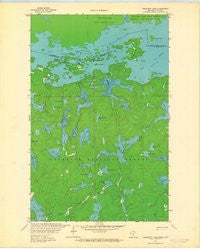
~ Takucmich Lake MN topo map, 1:24000 scale, 7.5 X 7.5 Minute, Historical, 1963, updated 1964
Takucmich Lake, Minnesota, USGS topographic map dated 1963.
Includes geographic coordinates (latitude and longitude). This topographic map is suitable for hiking, camping, and exploring, or framing it as a wall map.
Printed on-demand using high resolution imagery, on heavy weight and acid free paper, or alternatively on a variety of synthetic materials.
Topos available on paper, Waterproof, Poly, or Tyvek. Usually shipping rolled, unless combined with other folded maps in one order.
- Product Number: USGS-5989076
- Free digital map download (high-resolution, GeoPDF): Takucmich Lake, Minnesota (file size: 6 MB)
- Map Size: please refer to the dimensions of the GeoPDF map above
- Weight (paper map): ca. 55 grams
- Map Type: POD USGS Topographic Map
- Map Series: HTMC
- Map Verison: Historical
- Cell ID: 44203
- Scan ID: 505957
- Imprint Year: 1964
- Woodland Tint: Yes
- Aerial Photo Year: 1959
- Field Check Year: 1963
- Datum: NAD27
- Map Projection: Polyconic
- Map published by United States Geological Survey
- Map Language: English
- Scanner Resolution: 508 dpi
- Map Cell Name: Takucmich Lake
- Grid size: 7.5 X 7.5 Minute
- Date on map: 1963
- Map Scale: 1:24000
- Geographical region: Minnesota, United States
Neighboring Maps:
All neighboring USGS topo maps are available for sale online at a variety of scales.
Spatial coverage:
Topo map Takucmich Lake, Minnesota, covers the geographical area associated the following places:
- Tesaker Lake - Slim Lake - Pageant Creek - Range Line Lake - Finger Creek - Hustler River - Range Line Creek - Lucky Finn Lake - Pocket Lake - Bourassa Lake - North Lake - Takucmich Lake - Twentyseven Island - Fortyone Island - Finger Lake - Haunted Lake - Hag Creek - Nahimana Lake - Fat Lake - Thumb Lake - Dome Island - Steep Lake - East Loon Bay - Gun Lake - Posse Lake - Mantle Lake - Heritage Creek - Beartrack Lake - Little Beartrack Lake - Pageant Lake - Trillium Lake - Deposit Lake - Brigand Lake - South Lake - Charm Lake - Contentment Lake - Eugene Lake - Trygg Lake
- Map Area ID: AREA48.37548.25-92.25-92.125
- Northwest corner Lat/Long code: USGSNW48.375-92.25
- Northeast corner Lat/Long code: USGSNE48.375-92.125
- Southwest corner Lat/Long code: USGSSW48.25-92.25
- Southeast corner Lat/Long code: USGSSE48.25-92.125
- Northern map edge Latitude: 48.375
- Southern map edge Latitude: 48.25
- Western map edge Longitude: -92.25
- Eastern map edge Longitude: -92.125


