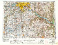
~ Saint Paul MN topo map, 1:250000 scale, 1 X 2 Degree, Historical, 1953, updated 1979
Saint Paul, Minnesota, USGS topographic map dated 1953.
Includes geographic coordinates (latitude and longitude). This topographic map is suitable for hiking, camping, and exploring, or framing it as a wall map.
Printed on-demand using high resolution imagery, on heavy weight and acid free paper, or alternatively on a variety of synthetic materials.
Topos available on paper, Waterproof, Poly, or Tyvek. Usually shipping rolled, unless combined with other folded maps in one order.
- Product Number: USGS-5988532
- Free digital map download (high-resolution, GeoPDF): Saint Paul, Minnesota (file size: 15 MB)
- Map Size: please refer to the dimensions of the GeoPDF map above
- Weight (paper map): ca. 55 grams
- Map Type: POD USGS Topographic Map
- Map Series: HTMC
- Map Verison: Historical
- Cell ID: 72246
- Scan ID: 503715
- Imprint Year: 1979
- Woodland Tint: Yes
- Aerial Photo Year: 1976
- Edit Year: 1979
- Field Check Year: 1953
- Datum: Unstated
- Map Projection: Transverse Mercator
- Map published by: Military, Other
- Map Language: English
- Scanner Resolution: 508 dpi
- Map Cell Name: Saint Paul
- Grid size: 1 X 2 Degree
- Date on map: 1953
- Map Scale: 1:250000
- Geographical region: Minnesota, United States
Neighboring Maps:
All neighboring USGS topo maps are available for sale online at a variety of scales.
Spatial coverage:
Topo map Saint Paul, Minnesota, covers the geographical area associated the following places:
- Marystown - Baden - Burnsville - Valley Green Mobile Home Park - Pemberton - Devils Corner - Diamond Bluff - Millville - Riverside Terrace Mobile Court - Minnetonka Beach - Deerfield - East Cottage Grove - Rice Lake - Green Valley Mobile Home Park - Sono Junction - Dodge Center - Concord - Waconia - Waseca - Tonka Bay - Hay Creek - Cannon City - Plum City - Hamburg - Lazy U Mobile Home Park - Shakopee - Merton - Hydes Lake - Waconia Trailer Court - Hatchville - Reads Landing - Bloomington - Roberts - Cedar Lake - Kingsway Estates - White Rock - Eureka Center - Waterford - Eggleston - Stockholm - Lime Valley Mobile Home Park - Northfield - Elgin - Ruskin - Welch Point (historical) - Saint Patrick - Lake Elysian - Kenyon - Clinton Falls - Maplewood Trailer Park - Faribault - Saint Paul Park - Savoy (historical) - Henderson - Hammond - Owatonna - Pine Bend - Welch - High Ciara Mobile Home Park - Morristown - Cologne - Saga Hill - Calhoun Beach - Snows Corner - Wacouta Beach - Nerike - Hoppe Mobile Home Park - Jackson Heights Trailer Park - Comus - Grand View Mobile Park - Saint Benedict - Valley View Terrace - Augusta - Orchard Garden - Maxville - Saint Thomas - Valley Haven Mobile Home Park - Saco - Forest Mills - Basswood Grove - Mantorville - Mudbaden - Pleasant Hill Manor - Smith Landing - Midland Junction - Medicine Lake - Wheatland - Saint Paul - Nininger - Pine Island - Vermillion - Apple Valley - New Germany - Rochester - Oster - Credit River - Weston - Minnetonka - Cedar Beach - South Fork Homes
- Map Area ID: AREA4544-94-92
- Northwest corner Lat/Long code: USGSNW45-94
- Northeast corner Lat/Long code: USGSNE45-92
- Southwest corner Lat/Long code: USGSSW44-94
- Southeast corner Lat/Long code: USGSSE44-92
- Northern map edge Latitude: 45
- Southern map edge Latitude: 44
- Western map edge Longitude: -94
- Eastern map edge Longitude: -92

