
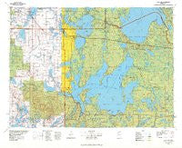
~ Cass Lake MN topo map, 1:100000 scale, 30 X 60 Minute, Historical, 1977, updated 1978
Cass Lake, Minnesota, USGS topographic map dated 1977.
Includes geographic coordinates (latitude and longitude). This topographic map is suitable for hiking, camping, and exploring, or framing it as a wall map.
Printed on-demand using high resolution imagery, on heavy weight and acid free paper, or alternatively on a variety of synthetic materials.
Topos available on paper, Waterproof, Poly, or Tyvek. Usually shipping rolled, unless combined with other folded maps in one order.
- Product Number: USGS-5985878
- Free digital map download (high-resolution, GeoPDF): Cass Lake, Minnesota (file size: 20 MB)
- Map Size: please refer to the dimensions of the GeoPDF map above
- Weight (paper map): ca. 55 grams
- Map Type: POD USGS Topographic Map
- Map Series: HTMC
- Map Verison: Historical
- Cell ID: 67251
- Scan ID: 804516
- Imprint Year: 1978
- Woodland Tint: Yes
- Datum: NAD27
- Map Projection: Universal Transverse Mercator
- Map published by United States Geological Survey
- Map Language: English
- Scanner Resolution: 508 dpi
- Map Cell Name: Cass Lake
- Grid size: 30 X 60 Minute
- Date on map: 1977
- Map Scale: 1:100000
- Geographical region: Minnesota, United States
Neighboring Maps:
All neighboring USGS topo maps are available for sale online at a variety of scales.
Spatial coverage:
Topo map Cass Lake, Minnesota, covers the geographical area associated the following places:
- Lake George - Lake George Pines Mobile Home Park - Bemidji - Kabekona Corner - Southview Mobile Home Park - Ken and Debi Lathrop Mobile Home Park - Cass Lake - Birchlane Mobile Home Park - Norway Park - Benedict - Akeley - Guthrie - Walker - Bald Eagle Center - Deer Lane - Rosby - Onigum - Bena - Wilkinson - Laporte - Skyline Mobile Park - Pennington - Tobique - Nary - Ah-gwah-ching - Ryan Village - Cuba (historical) - Whipholt - Country Lane Manufactured Home Park - Baker - Federal Dam - Brevik - Andrusia - Emmaville - Farris - Schley - Boy River
- Map Area ID: AREA47.547-95-94
- Northwest corner Lat/Long code: USGSNW47.5-95
- Northeast corner Lat/Long code: USGSNE47.5-94
- Southwest corner Lat/Long code: USGSSW47-95
- Southeast corner Lat/Long code: USGSSE47-94
- Northern map edge Latitude: 47.5
- Southern map edge Latitude: 47
- Western map edge Longitude: -95
- Eastern map edge Longitude: -94


