
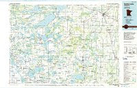
~ Battle Lake MN topo map, 1:100000 scale, 30 X 60 Minute, Historical, 1986, updated 1986
Battle Lake, Minnesota, USGS topographic map dated 1986.
Includes geographic coordinates (latitude and longitude). This topographic map is suitable for hiking, camping, and exploring, or framing it as a wall map.
Printed on-demand using high resolution imagery, on heavy weight and acid free paper, or alternatively on a variety of synthetic materials.
Topos available on paper, Waterproof, Poly, or Tyvek. Usually shipping rolled, unless combined with other folded maps in one order.
- Product Number: USGS-5985418
- Free digital map download (high-resolution, GeoPDF): Battle Lake, Minnesota (file size: 15 MB)
- Map Size: please refer to the dimensions of the GeoPDF map above
- Weight (paper map): ca. 55 grams
- Map Type: POD USGS Topographic Map
- Map Series: HTMC
- Map Verison: Historical
- Cell ID: 67106
- Scan ID: 805578
- Imprint Year: 1986
- Woodland Tint: Yes
- Aerial Photo Year: 1984
- Edit Year: 1986
- Datum: NAD27
- Map Projection: Universal Transverse Mercator
- Planimetric: Yes
- Map published by United States Geological Survey
- Map Language: English
- Scanner Resolution: 508 dpi
- Map Cell Name: Battle Lake
- Grid size: 30 X 60 Minute
- Date on map: 1986
- Map Scale: 1:100000
- Geographical region: Minnesota, United States
Neighboring Maps:
All neighboring USGS topo maps are available for sale online at a variety of scales.
Spatial coverage:
Topo map Battle Lake, Minnesota, covers the geographical area associated the following places:
- Maine - Hewitt - Amor - Ottertail - Ashby - Millerville - Rose City - Battle Lake Mobile Home Court - Almora - Verndale - Bluffton - Heinola - Miltona - Wadena - Vining - Basswood - West Wind Estates - Inglewood - Dalton Trailer Court - Parkers Prairie - Leaf Valley - Nirvana - Underwood - Bertha - Topelius (historical) - Phelps - Wrightstown - Lyman - Eagle Bend - Edwards - Clotho - Dalton - Deer Creek - Battle Lake - Henning - Deer Creek Mobile Home Park - Leaf City (historical) - Melby - Clitherall - Spruce Center - Evansville - Urbank - Wall Lake - Parkers Prairie Park - Clitherall Lake Mobile Home Park - Woodland Park
- Map Area ID: AREA46.546-96-95
- Northwest corner Lat/Long code: USGSNW46.5-96
- Northeast corner Lat/Long code: USGSNE46.5-95
- Southwest corner Lat/Long code: USGSSW46-96
- Southeast corner Lat/Long code: USGSSE46-95
- Northern map edge Latitude: 46.5
- Southern map edge Latitude: 46
- Western map edge Longitude: -96
- Eastern map edge Longitude: -95


