
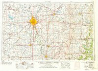
~ Wichita KS topo map, 1:250000 scale, 1 X 2 Degree, Historical, 1955, updated 1976
Wichita, Kansas, USGS topographic map dated 1955.
Includes geographic coordinates (latitude and longitude). This topographic map is suitable for hiking, camping, and exploring, or framing it as a wall map.
Printed on-demand using high resolution imagery, on heavy weight and acid free paper, or alternatively on a variety of synthetic materials.
Topos available on paper, Waterproof, Poly, or Tyvek. Usually shipping rolled, unless combined with other folded maps in one order.
- Product Number: USGS-5974380
- Free digital map download (high-resolution, GeoPDF): Wichita, Kansas (file size: 11 MB)
- Map Size: please refer to the dimensions of the GeoPDF map above
- Weight (paper map): ca. 55 grams
- Map Type: POD USGS Topographic Map
- Map Series: HTMC
- Map Verison: Historical
- Cell ID: 69097
- Scan ID: 802034
- Imprint Year: 1976
- Woodland Tint: Yes
- Aerial Photo Year: 1954
- Edit Year: 1966
- Field Check Year: 1955
- Datum: NAD27
- Map Projection: Transverse Mercator
- Map published by United States Army Corps of Engineers
- Map published by United States Army
- Map Language: English
- Scanner Resolution: 508 dpi
- Map Cell Name: Wichita
- Grid size: 1 X 2 Degree
- Date on map: 1955
- Map Scale: 1:250000
- Geographical region: Kansas, United States
Neighboring Maps:
All neighboring USGS topo maps are available for sale online at a variety of scales.
Spatial coverage:
Topo map Wichita, Kansas, covers the geographical area associated the following places:
- Thompsons Mobile Home Park - Oxford - Glenview Estates Mobile Home Park - Rock - Dahna Mobile Home Park - Tonovay - Tyler - Englewood Mobile Home Park - Childs Acres - Rolling Meadows Mobile Home Park - Maple City - Augusta - Hawk - Elk Falls - Moline - Cicero - Mobile Manor Estates Mobile Home Park - Grafton - Lakeview Heights - Darlow - Valley Center - Eastborough - Mona Kay Heights - Layton - K - 15 Mobile Home Park - Clay Center - Travel - Air Mobile Home Park - Diamond Spur Trailer Court - Westlink Village - Patterson - Bonnie Brae - Summit - Belmont - De Graff - Ewell - Orsemus - Millerton - Corbin - Grenola - Hopkins - Lakeside Manufactured Home Community - MacArthur Place Mobile Home Park - Country Side Mobile Home Park - Linnell Mobile Home Park - Parkerfield - Powell Mobile Home Park - Kamar Parkette Trailer Park - Hewins - Silver Spur III Mobile Home Park - Bushnell - Cedar Ridge Mobile Home Park - Stroud Mobile Home Park - Grand Summit - Glen Crouse - Floral - Haven - Reece - Freeport - Milton - Oak Ridge Mobile Home Community - Deer Lake Mobile Home Estates - Hanks Mobile Home Park - Waco - Country Acres Mobile Home Park - Sedan - Adamsville - Perrine Mobile Home Park - Riverdale - Lakeview Mobile Home Park - Severy - Mayfield - Midtown Mobile Home Park - Wilmot - Dexter - Danville - Murdock - Wayne Smith Mobile Home Park - Young Mobile Home Park - New Salem - Lamplighter Mobile Home Park - Welcome Home Community Mobile Home Park - Harbor Mobile Home Park - Arkansas City - Rosalia - Park City - Furley - Potwin - Pleasant Valley (historical) - South Seneca Gardens - Kechi - Wellington - Taussig - Silver Spur Mobile Home Park - Sandalwood Mobile Home Park - Sunnydale - County Acres - Elmer - Sunset Acres - El Caudillo Mobile Home Park - Hale
- Map Area ID: AREA3837-98-96
- Northwest corner Lat/Long code: USGSNW38-98
- Northeast corner Lat/Long code: USGSNE38-96
- Southwest corner Lat/Long code: USGSSW37-98
- Southeast corner Lat/Long code: USGSSE37-96
- Northern map edge Latitude: 38
- Southern map edge Latitude: 37
- Western map edge Longitude: -98
- Eastern map edge Longitude: -96


