
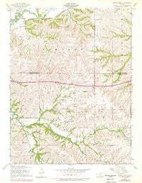
~ Swede Creek KS topo map, 1:24000 scale, 7.5 X 7.5 Minute, Historical, 1955, updated 1978
Swede Creek, Kansas, USGS topographic map dated 1955.
Includes geographic coordinates (latitude and longitude). This topographic map is suitable for hiking, camping, and exploring, or framing it as a wall map.
Printed on-demand using high resolution imagery, on heavy weight and acid free paper, or alternatively on a variety of synthetic materials.
Topos available on paper, Waterproof, Poly, or Tyvek. Usually shipping rolled, unless combined with other folded maps in one order.
- Product Number: USGS-5973954
- Free digital map download (high-resolution, GeoPDF): Swede Creek, Kansas (file size: 9 MB)
- Map Size: please refer to the dimensions of the GeoPDF map above
- Weight (paper map): ca. 55 grams
- Map Type: POD USGS Topographic Map
- Map Series: HTMC
- Map Verison: Historical
- Cell ID: 43997
- Scan ID: 512603
- Imprint Year: 1978
- Woodland Tint: Yes
- Photo Revision Year: 1978
- Aerial Photo Year: 1977
- Edit Year: 1978
- Field Check Year: 1955
- Datum: NAD27
- Map Projection: Polyconic
- Map published by United States Army Corps of Engineers
- Map Language: English
- Scanner Resolution: 508 dpi
- Map Cell Name: Swede Creek
- Grid size: 7.5 X 7.5 Minute
- Date on map: 1955
- Map Scale: 1:24000
- Geographical region: Kansas, United States
Neighboring Maps:
All neighboring USGS topo maps are available for sale online at a variety of scales.
Spatial coverage:
Topo map Swede Creek, Kansas, covers the geographical area associated the following places:
- Kansas Department of Transportation Geary County Rest Area Interstate 70 East - Briggs (historical) - Geary County Rural Fire Department Station 7 - South Branch - Thierer Branch - Poole Branch - Briggs Branch - Deadman Creek - Township of Ashland - Ashland Cemetery - MacArthur Branch - School Number 4 (historical) - Cleveland School - North Branch - Jewell County Lake - West McDowell Creek - Briggs School - Riley County Fire District 1 Station 2 - Swede Creek - South Branch Kings Creek - McDowell Creek School - Kings Creek - East McDowell Creek - Ashland - Kansas Department of Transportation Geary County Rest Area Interstate 70 West - Konza Prairie Natural Area - Horne Branch - Briggs Cemetery - North Branch Kings Creek - Township of Jackson
- Map Area ID: AREA39.12539-96.625-96.5
- Northwest corner Lat/Long code: USGSNW39.125-96.625
- Northeast corner Lat/Long code: USGSNE39.125-96.5
- Southwest corner Lat/Long code: USGSSW39-96.625
- Southeast corner Lat/Long code: USGSSE39-96.5
- Northern map edge Latitude: 39.125
- Southern map edge Latitude: 39
- Western map edge Longitude: -96.625
- Eastern map edge Longitude: -96.5


