
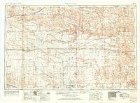
~ Scott City KS topo map, 1:250000 scale, 1 X 2 Degree, Historical, 1955, updated 1969
Scott City, Kansas, USGS topographic map dated 1955.
Includes geographic coordinates (latitude and longitude). This topographic map is suitable for hiking, camping, and exploring, or framing it as a wall map.
Printed on-demand using high resolution imagery, on heavy weight and acid free paper, or alternatively on a variety of synthetic materials.
Topos available on paper, Waterproof, Poly, or Tyvek. Usually shipping rolled, unless combined with other folded maps in one order.
- Product Number: USGS-5973572
- Free digital map download (high-resolution, GeoPDF): Scott City, Kansas (file size: 9 MB)
- Map Size: please refer to the dimensions of the GeoPDF map above
- Weight (paper map): ca. 55 grams
- Map Type: POD USGS Topographic Map
- Map Series: HTMC
- Map Verison: Historical
- Cell ID: 72247
- Scan ID: 801983
- Imprint Year: 1969
- Aerial Photo Year: 1954
- Edit Year: 1968
- Field Check Year: 1955
- Datum: NAD27
- Map Projection: Transverse Mercator
- Map published by United States Army Corps of Engineers
- Map published by United States Army
- Map Language: English
- Scanner Resolution: 508 dpi
- Map Cell Name: Scott City
- Grid size: 1 X 2 Degree
- Date on map: 1955
- Map Scale: 1:250000
- Geographical region: Kansas, United States
Neighboring Maps:
All neighboring USGS topo maps are available for sale online at a variety of scales.
Spatial coverage:
Topo map Scott City, Kansas, covers the geographical area associated the following places:
- Manning - Rodkey - Russell Springs - Pence - Lowe - Modoc - Whitelaw - Beeler - Alamota - Horace - Wallace - Selkirk - Walkinghood - Peterson - Wolf - Amy - Lydia - Elkader - Sunland - Astor - Ravanna - Grigston - Country Acres Trailer Park - Friend - Sharon Springs - Unified Government of Greeley County (balance) - Utica - Shields - Tennis - Kalvesta - Gano - Chevron - Ritchal - Dighton - Scott City - Shallow Water - Gove - Arnold - Healy - Weskan - Laird - Alanthus - Hutchins - Marienthal - Tribune - Coronado - Yeadon Trailer Park - Leoti - Medway
- Map Area ID: AREA3938-102-100
- Northwest corner Lat/Long code: USGSNW39-102
- Northeast corner Lat/Long code: USGSNE39-100
- Southwest corner Lat/Long code: USGSSW38-102
- Southeast corner Lat/Long code: USGSSE38-100
- Northern map edge Latitude: 39
- Southern map edge Latitude: 38
- Western map edge Longitude: -102
- Eastern map edge Longitude: -100


