
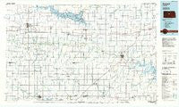
~ Russell KS topo map, 1:100000 scale, 30 X 60 Minute, Historical, 1985, updated 1985
Russell, Kansas, USGS topographic map dated 1985.
Includes geographic coordinates (latitude and longitude). This topographic map is suitable for hiking, camping, and exploring, or framing it as a wall map.
Printed on-demand using high resolution imagery, on heavy weight and acid free paper, or alternatively on a variety of synthetic materials.
Topos available on paper, Waterproof, Poly, or Tyvek. Usually shipping rolled, unless combined with other folded maps in one order.
- Product Number: USGS-5973490
- Free digital map download (high-resolution, GeoPDF): Russell, Kansas (file size: 12 MB)
- Map Size: please refer to the dimensions of the GeoPDF map above
- Weight (paper map): ca. 55 grams
- Map Type: POD USGS Topographic Map
- Map Series: HTMC
- Map Verison: Historical
- Cell ID: 68270
- Scan ID: 801634
- Imprint Year: 1985
- Woodland Tint: Yes
- Aerial Photo Year: 1981
- Edit Year: 1985
- Datum: NAD27
- Map Projection: Universal Transverse Mercator
- Planimetric: Yes
- Map published by United States Geological Survey
- Map Language: English
- Scanner Resolution: 508 dpi
- Map Cell Name: Russell
- Grid size: 30 X 60 Minute
- Date on map: 1985
- Map Scale: 1:100000
- Geographical region: Kansas, United States
Neighboring Maps:
All neighboring USGS topo maps are available for sale online at a variety of scales.
Spatial coverage:
Topo map Russell, Kansas, covers the geographical area associated the following places:
- Stickney - Edalgo - Yankee Run - Carneiro - Russell - Claflin - Dorrance - Olmitz - Beaver - Hoisington - Barton - Westfall - Midway - Dumler Mobile Home Estates - Boyd - Frantz (historical) - Dubuque - Bunker Hill - Millard - Homer - South Hoisington - Balta - Lipprand Trailer Park - Wilson - Crawford - Lorraine - Susank - Galatia - Redwing - Farhman - Kanopolis - Milberger - Bushton - Holyrood - Odin - Ellsworth - Hitschmann - Geneseo - Black Wolf - Frederick
- Map Area ID: AREA3938.5-99-98
- Northwest corner Lat/Long code: USGSNW39-99
- Northeast corner Lat/Long code: USGSNE39-98
- Southwest corner Lat/Long code: USGSSW38.5-99
- Southeast corner Lat/Long code: USGSSE38.5-98
- Northern map edge Latitude: 39
- Southern map edge Latitude: 38.5
- Western map edge Longitude: -99
- Eastern map edge Longitude: -98


