
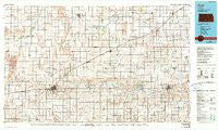
~ Pratt KS topo map, 1:100000 scale, 30 X 60 Minute, Historical, 1985, updated 1990
Pratt, Kansas, USGS topographic map dated 1985.
Includes geographic coordinates (latitude and longitude). This topographic map is suitable for hiking, camping, and exploring, or framing it as a wall map.
Printed on-demand using high resolution imagery, on heavy weight and acid free paper, or alternatively on a variety of synthetic materials.
Topos available on paper, Waterproof, Poly, or Tyvek. Usually shipping rolled, unless combined with other folded maps in one order.
- Product Number: USGS-5973266
- Free digital map download (high-resolution, GeoPDF): Pratt, Kansas (file size: 16 MB)
- Map Size: please refer to the dimensions of the GeoPDF map above
- Weight (paper map): ca. 55 grams
- Map Type: POD USGS Topographic Map
- Map Series: HTMC
- Map Verison: Historical
- Cell ID: 68188
- Scan ID: 801630
- Imprint Year: 1990
- Woodland Tint: Yes
- Photo Inspection Year: 1989
- Aerial Photo Year: 1981
- Edit Year: 1985
- Datum: NAD27
- Map Projection: Universal Transverse Mercator
- Map published by United States Geological Survey
- Map Language: English
- Scanner Resolution: 508 dpi
- Map Cell Name: Pratt
- Grid size: 30 X 60 Minute
- Date on map: 1985
- Map Scale: 1:100000
- Geographical region: Kansas, United States
Neighboring Maps:
All neighboring USGS topo maps are available for sale online at a variety of scales.
Spatial coverage:
Topo map Pratt, Kansas, covers the geographical area associated the following places:
- Georgia - Saint Leo - Cairo - Byers - Cleveland - Macksville - Country Mobile Home Estates Community - Lerado - Varner - Langdon - Willowdale - Iuka - Cullison - Springvale - Skellyville - Waldeck - Pretty Prairie - Kingman - Dillwyn - Alameda - Plevna - Green Acres Trailer Court - Mound Street Mobile Home Park - Abbyville - Pratt - Calista - Arlington - Cunningham - Hopewell - Stafford - Coats - Zenith - Croft - Natrona - Neola - Penalosa - Preston - Partridge - Sylvia - Basil - Turon
- Map Area ID: AREA3837.5-99-98
- Northwest corner Lat/Long code: USGSNW38-99
- Northeast corner Lat/Long code: USGSNE38-98
- Southwest corner Lat/Long code: USGSSW37.5-99
- Southeast corner Lat/Long code: USGSSE37.5-98
- Northern map edge Latitude: 38
- Southern map edge Latitude: 37.5
- Western map edge Longitude: -99
- Eastern map edge Longitude: -98


