
~ Lawrence KS topo map, 1:250000 scale, 1 X 2 Degree, Historical, 1947, updated 1954
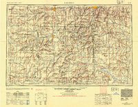
Lawrence, Kansas, USGS topographic map dated 1947.
Includes geographic coordinates (latitude and longitude). This topographic map is suitable for hiking, camping, and exploring, or framing it as a wall map.
Printed on-demand using high resolution imagery, on heavy weight and acid free paper, or alternatively on a variety of synthetic materials.
Topos available on paper, Waterproof, Poly, or Tyvek. Usually shipping rolled, unless combined with other folded maps in one order.
- Product Number: USGS-5972058
- Free digital map download (high-resolution, GeoPDF): Lawrence, Kansas (file size: 11 MB)
- Map Size: please refer to the dimensions of the GeoPDF map above
- Weight (paper map): ca. 55 grams
- Map Type: POD USGS Topographic Map
- Map Series: HTMC
- Map Verison: Historical
- Cell ID: 68869
- Scan ID: 801844
- Imprint Year: 1954
- Aerial Photo Year: 1945
- Datum: NAD27
- Map Projection: Transverse Mercator
- Shaded Relief map: Yes
- Map published by United States Army Corps of Engineers
- Map published by United States Army
- Map Language: English
- Scanner Resolution: 508 dpi
- Map Cell Name: Lawrence
- Grid size: 1 X 2 Degree
- Date on map: 1947
- Map Scale: 1:250000
- Geographical region: Kansas, United States
Neighboring Maps:
All neighboring USGS topo maps are available for sale online at a variety of scales.
Spatial coverage:
Topo map Lawrence, Kansas, covers the geographical area associated the following places:
- Sharpe - Arvonia - Burdett - Schell City - LeRoy - Rantoul - Ore - Trading Post - Rural Home (historical) - New Home - South Lee - Prettyman - New Lancaster - Belton - Ottumwa - Daugherty - Wagstaff - Globe - Henson - Arthur - Tarsney Lakes - La Cygne Corner - Leawood - Cullen Village - Wingate - Ridgeton - Warsop Mobile Home Park - Indian Village - Hickman Mills - Jeffreys - Geneva - Mayesburg - Lebo - Michigan Valley - Vale - Fulkerson - Reynard (historical) - Gaslight Village Mobile Home Park - Amoret - Conestoga Estates Mobile Home Park - Bush City - Barnesville - Avon - Latour - Centropolis - Imes - Waldo - Berryton - Walters Mobile Home Park - Craig - Prairie Village - Peculiar - Unity Village - Bosworth Mobile Home Park - Blue Mound - Black Jack - Central - Rockville - Indian Springs - Lawrence - Prairie City - Dodson - Appleton City - Pleasant Hill - Knobtown - Raymore - Lebo Mobile Home Park - Spring Hill - Urich - Drexel - Prairie Center (historical) - Gridley - Rich Hill - Baldwin Park - Colony - Nyhart - Martin City - Clare - Linn Valley - Green Acres Mobile Home Park - Crescent Hill - Monticello - Botham Mobile Home Park - Dallas - Hudson - New Santa Fe - Ocheltree - Waverly - Ruskin - Wolfe (historical) - Acres Mobile Home Estate Park - Osawatomie - Harrelson - Bonita - Blue Oaks and Live Oaks Mobile Home Park - Redel - Bucyrus - Elm - Pleasanton - Baldwin City
- Map Area ID: AREA3938-96-94
- Northwest corner Lat/Long code: USGSNW39-96
- Northeast corner Lat/Long code: USGSNE39-94
- Southwest corner Lat/Long code: USGSSW38-96
- Southeast corner Lat/Long code: USGSSE38-94
- Northern map edge Latitude: 39
- Southern map edge Latitude: 38
- Western map edge Longitude: -96
- Eastern map edge Longitude: -94


