
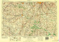
~ Lawrence KS topo map, 1:250000 scale, 1 X 2 Degree, Historical, 1961, updated 1961
Lawrence, Kansas, USGS topographic map dated 1961.
Includes geographic coordinates (latitude and longitude). This topographic map is suitable for hiking, camping, and exploring, or framing it as a wall map.
Printed on-demand using high resolution imagery, on heavy weight and acid free paper, or alternatively on a variety of synthetic materials.
Topos available on paper, Waterproof, Poly, or Tyvek. Usually shipping rolled, unless combined with other folded maps in one order.
- Product Number: USGS-5972056
- Free digital map download (high-resolution, GeoPDF): Lawrence, Kansas (file size: 12 MB)
- Map Size: please refer to the dimensions of the GeoPDF map above
- Weight (paper map): ca. 55 grams
- Map Type: POD USGS Topographic Map
- Map Series: HTMC
- Map Verison: Historical
- Cell ID: 68869
- Scan ID: 801843
- Imprint Year: 1961
- Woodland Tint: Yes
- Aerial Photo Year: 1950
- Field Check Year: 1956
- Datum: NAD27
- Map Projection: Transverse Mercator
- Map published by United States Army Corps of Engineers
- Map published by United States Army
- Map Language: English
- Scanner Resolution: 508 dpi
- Map Cell Name: Lawrence
- Grid size: 1 X 2 Degree
- Date on map: 1961
- Map Scale: 1:250000
- Geographical region: Kansas, United States
Neighboring Maps:
All neighboring USGS topo maps are available for sale online at a variety of scales.
Spatial coverage:
Topo map Lawrence, Kansas, covers the geographical area associated the following places:
- Leawood - Globe - Westphalia - Carbondale - Longview - Dodson - Paola - Lindale - Beagle - Hartford - Stanton - Ballard - Blue Oaks and Live Oaks Mobile Home Park - Morse - Prescott - Aliceville - Monticello - Lenape - Maple Leaf Mobile Home Park - Monteith Junction - Mineral Springs - Santa Barbara Mobile Home Park - Flinn - Rucker - Bryant - Rockford (historical) - Four Corners - Vassar - Everett - Mantey - Garnett - Bosworth Mobile Home Park - Riverside Mobile Home Park - Lawrence - Daugherty - Knobtown - Waldo - Gowdy - Gardner - Fulkerson - Unity Village - Fenwick - Antioch - Craig - Harveyville - Ransomville - Green Acres Mobile Home Park - Berryton - Lento - Central - Pauline - Crescent Hill - Avon - LeRoy - Harper Woods Mobile Home Park - Rantoul - New Santa Fe - Quick City - Osage City - Raymore - Melville - Somerset - Conestoga Estates Mobile Home Park - Watson - Hadsell - Cherrywoods Mobile Home Park - Lone Elm - Peru (historical) - Dunlay - Pine Hills Mobile Home Park - Prettyman - Beto Junction - Mayesburg - Rich Hill - Prairie City - Baldwin City - Jaudon - Centerville - Acres Mobile Home Estate Park - Blue Mound - Tarsney Lakes - Shady Acres Mobile Home Park - Vinland - Huber - Clinton - Miller - Papinville - Swissvale - Mulberry - Altona - Wagstaff - Urich - Weaver - Overbrook - Prairie Village - Scranton - Ottumwa - Williamsburg - Latour - Adrian
- Map Area ID: AREA3938-96-94
- Northwest corner Lat/Long code: USGSNW39-96
- Northeast corner Lat/Long code: USGSNE39-94
- Southwest corner Lat/Long code: USGSSW38-96
- Southeast corner Lat/Long code: USGSSE38-94
- Northern map edge Latitude: 39
- Southern map edge Latitude: 38
- Western map edge Longitude: -96
- Eastern map edge Longitude: -94


