
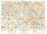
~ Hutchinson KS topo map, 1:250000 scale, 1 X 2 Degree, Historical, 1955, updated 1967
Hutchinson, Kansas, USGS topographic map dated 1955.
Includes geographic coordinates (latitude and longitude). This topographic map is suitable for hiking, camping, and exploring, or framing it as a wall map.
Printed on-demand using high resolution imagery, on heavy weight and acid free paper, or alternatively on a variety of synthetic materials.
Topos available on paper, Waterproof, Poly, or Tyvek. Usually shipping rolled, unless combined with other folded maps in one order.
- Product Number: USGS-5971654
- Free digital map download (high-resolution, GeoPDF): Hutchinson, Kansas (file size: 12 MB)
- Map Size: please refer to the dimensions of the GeoPDF map above
- Weight (paper map): ca. 55 grams
- Map Type: POD USGS Topographic Map
- Map Series: HTMC
- Map Verison: Historical
- Cell ID: 72229
- Scan ID: 801794
- Imprint Year: 1967
- Woodland Tint: Yes
- Aerial Photo Year: 1954
- Edit Year: 1967
- Field Check Year: 1955
- Datum: NAD27
- Map Projection: Transverse Mercator
- Map published by United States Army Corps of Engineers
- Map published by United States Army
- Map Language: English
- Scanner Resolution: 508 dpi
- Map Cell Name: Hutchinson
- Grid size: 1 X 2 Degree
- Date on map: 1955
- Map Scale: 1:250000
- Geographical region: Kansas, United States
Neighboring Maps:
All neighboring USGS topo maps are available for sale online at a variety of scales.
Spatial coverage:
Topo map Hutchinson, Kansas, covers the geographical area associated the following places:
- Allen - Pioneer Mobile Home Village - Jacobs - Venango - Patio Mobile Home Manor - Prairie Estates Mobile Home Park - Dunlap - Culver - New Gottland - Genes Mobile Home Park - Mustang Mobile Park - Windom - Gladstone - Ellinor - Waldeck - Eskridge - Hedville - Salina - Aulne - Bavaria - Langley - Alta Mills - Alta Vista - Burkett - Smokey Valley Mobile Home Park - Prairie Village Mobile Home Park - Westhill Mobile Home Park - Teterville - Salemsborg - Strong City - Lamont - Medora - Ramona - Marquette - White City - Walton - Marydel - Eastshore - McGraw - Burns - Del - Ray Mobile Estates - Kipp - Applewood Meadows Manufactured Home Community - Hilltop - Canada - Obeeville - Galva - Hessdale - Saffordville - Sand Creek - Southwestern Mobile Home Park - Carlton - Latimer - Elmo - Wilsey - Jenkins - Keene - Solomon - Arcola - Willowbrook - Burdick - Hymer - Wonsevu - Elmdale - Downing (historical) - Paxton - Delavan - El Haro Mobile Home Park - Juniata - Shady Brook - Diamond Springs - Country Aire Mobile Home Park - New Cambria - Marion - Durham - Phillips Village (historical) - Hesston - Golden Spur Mobile Home Park - Elyria - Enterprise - Lehigh - Goessel - Florence - Red Rock Mobile Home Park - Mackie - Dillon - Sundowner West Meadows Mobile Home Park - Bradford - Admire - South Hutchinson - Town and Country Village Mobile Home Park - Glendale - Emporia Junction - Emporia - Rishel - Lindsborg - Moundridge - Smolan - Lyona - Melody Acres Mobile Home Park
- Map Area ID: AREA3938-98-96
- Northwest corner Lat/Long code: USGSNW39-98
- Northeast corner Lat/Long code: USGSNE39-96
- Southwest corner Lat/Long code: USGSSW38-98
- Southeast corner Lat/Long code: USGSSE38-96
- Northern map edge Latitude: 39
- Southern map edge Latitude: 38
- Western map edge Longitude: -98
- Eastern map edge Longitude: -96


