
~ Hutchinson KS topo map, 1:250000 scale, 1 X 2 Degree, Historical, 1955, updated 1980
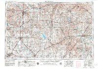
Hutchinson, Kansas, USGS topographic map dated 1955.
Includes geographic coordinates (latitude and longitude). This topographic map is suitable for hiking, camping, and exploring, or framing it as a wall map.
Printed on-demand using high resolution imagery, on heavy weight and acid free paper, or alternatively on a variety of synthetic materials.
Topos available on paper, Waterproof, Poly, or Tyvek. Usually shipping rolled, unless combined with other folded maps in one order.
- Product Number: USGS-5971652
- Free digital map download (high-resolution, GeoPDF): Hutchinson, Kansas (file size: 13 MB)
- Map Size: please refer to the dimensions of the GeoPDF map above
- Weight (paper map): ca. 55 grams
- Map Type: POD USGS Topographic Map
- Map Series: HTMC
- Map Verison: Historical
- Cell ID: 72229
- Scan ID: 801793
- Imprint Year: 1980
- Woodland Tint: Yes
- Aerial Photo Year: 1954
- Edit Year: 1969
- Field Check Year: 1955
- Datum: NAD27
- Map Projection: Transverse Mercator
- Map published by United States Geological Survey
- Map published by: Military, Other
- Map Language: English
- Scanner Resolution: 508 dpi
- Map Cell Name: Hutchinson
- Grid size: 1 X 2 Degree
- Date on map: 1955
- Map Scale: 1:250000
- Geographical region: Kansas, United States
Neighboring Maps:
All neighboring USGS topo maps are available for sale online at a variety of scales.
Spatial coverage:
Topo map Hutchinson, Kansas, covers the geographical area associated the following places:
- Pilsen - Eastshore - Country Club Mobile Home Estates - New Cambria - Hillsboro - Moundridge - Lang - Salina - Cottonwood Mobile Home Park - Oursler - Paradise Mobile Home Park - Emporia Junction - Rishel - Diamond Springs - Madison - Elbing - Berkeley Hills - Bridgeport - Punkin Center - Falun - Lamont - John's Mobile Home Park - Hymer - Waldeck - Hessdale - Dwight - Acme - Western Community Park - Brookville - White City - Rollin Homes Mobile Home Court - Hallville - Alta Vista - Volland - Delavan - Buhler - Patio Mobile Home Manor - Bazaar - Hilltop - Cottonwood Falls - Hope - New Gottland - Sundowner West Meadows Mobile Home Park - Kenbro - Keene - Bavaria - Kanopolis Lake Park - Cassoday - Bradford - Brookhaven Mobile Home Village - Aulne - Enterprise - Wreford - Helmick - Juniata - Cedar Creek Mobile Home Park - Paxton - Dillon - Hutchinson - Melody Acres Mobile Home Park - Shipton - Admire - Inman - Freemount - Conway - Hilton - Phillips Village (historical) - M and M Mobile Home Court - Kansas Falls - Elyria - Canton - Chapman - Lehigh - Kelso - Strong City - Saffordville - Genes Mobile Home Park - Glendale - Ellinor - Red Rock Mobile Home Park - Lindsborg - Durham - Smokey Valley Mobile Home Park - Wonsevu - Trenton - Eskridge - McGraw - Windom - Smolan - Matfield Green - Sand Creek - Florence - Burns - Belmont Mobile Home Estates - Tampa - Newton - Arcola - Galva - Shamrock Mobile Home Estates - Olpe
- Map Area ID: AREA3938-98-96
- Northwest corner Lat/Long code: USGSNW39-98
- Northeast corner Lat/Long code: USGSNE39-96
- Southwest corner Lat/Long code: USGSSW38-98
- Southeast corner Lat/Long code: USGSSE38-96
- Northern map edge Latitude: 39
- Southern map edge Latitude: 38
- Western map edge Longitude: -98
- Eastern map edge Longitude: -96


