
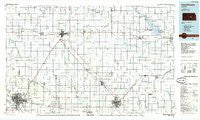
~ Hutchinson KS topo map, 1:100000 scale, 30 X 60 Minute, Historical, 1985, updated 1985
Hutchinson, Kansas, USGS topographic map dated 1985.
Includes geographic coordinates (latitude and longitude). This topographic map is suitable for hiking, camping, and exploring, or framing it as a wall map.
Printed on-demand using high resolution imagery, on heavy weight and acid free paper, or alternatively on a variety of synthetic materials.
Topos available on paper, Waterproof, Poly, or Tyvek. Usually shipping rolled, unless combined with other folded maps in one order.
- Product Number: USGS-5971650
- Free digital map download (high-resolution, GeoPDF): Hutchinson, Kansas (file size: 12 MB)
- Map Size: please refer to the dimensions of the GeoPDF map above
- Weight (paper map): ca. 55 grams
- Map Type: POD USGS Topographic Map
- Map Series: HTMC
- Map Verison: Historical
- Cell ID: 67695
- Scan ID: 801605
- Imprint Year: 1985
- Woodland Tint: Yes
- Aerial Photo Year: 1981
- Edit Year: 1985
- Datum: NAD27
- Map Projection: Universal Transverse Mercator
- Planimetric: Yes
- Map published by United States Geological Survey
- Map Language: English
- Scanner Resolution: 508 dpi
- Map Cell Name: Hutchinson
- Grid size: 30 X 60 Minute
- Date on map: 1985
- Map Scale: 1:100000
- Geographical region: Kansas, United States
Neighboring Maps:
All neighboring USGS topo maps are available for sale online at a variety of scales.
Spatial coverage:
Topo map Hutchinson, Kansas, covers the geographical area associated the following places:
- Hillsboro - Conway - Galva - Applewood Meadows Manufactured Home Community - Canton - Groveland - Hutchinson Regency Mobile Home Park - Burrton - Brookhaven Mobile Home Village - Showalter Mobile Home Park - Waldeck - Halstead - North Newton - Newton - Mac's Mobile Home Park - Country Club Mobile Home Estates - Durham - Hilton - Aulne - Sands Mobile Home Park and Rentals - Obeeville - Elyria - Western Community Park - New Gottland - Hutchinson - Walton - Peabody - Alta Mills - Eastshore - Zimmerdale - Sand Creek - Town and Country Village Mobile Home Park - Rollin Homes Mobile Home Court - Paxton - Moundridge - Coach Lamp Village Mobile Home Park I - Mustang Mobile Park - Windom - Lehigh - Pilsen - Johnstown - Medora - Elbing - Buhler - Willowbrook - Greenlawn Trailer Park - Canada - McPherson - Country Aire Mobile Home Park - Goessel - Prairie Estates Mobile Home Park - Melody Acres Mobile Home Park - Marion - South Hutchinson - McGraw - Inman - Punkin Center - Hesston
- Map Area ID: AREA38.538-98-97
- Northwest corner Lat/Long code: USGSNW38.5-98
- Northeast corner Lat/Long code: USGSNE38.5-97
- Southwest corner Lat/Long code: USGSSW38-98
- Southeast corner Lat/Long code: USGSSE38-97
- Northern map edge Latitude: 38.5
- Southern map edge Latitude: 38
- Western map edge Longitude: -98
- Eastern map edge Longitude: -97


