
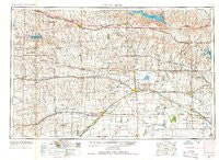
~ Great Bend KS topo map, 1:250000 scale, 1 X 2 Degree, Historical, 1955, updated 1966
Great Bend, Kansas, USGS topographic map dated 1955.
Includes geographic coordinates (latitude and longitude). This topographic map is suitable for hiking, camping, and exploring, or framing it as a wall map.
Printed on-demand using high resolution imagery, on heavy weight and acid free paper, or alternatively on a variety of synthetic materials.
Topos available on paper, Waterproof, Poly, or Tyvek. Usually shipping rolled, unless combined with other folded maps in one order.
- Product Number: USGS-5971246
- Free digital map download (high-resolution, GeoPDF): Great Bend, Kansas (file size: 11 MB)
- Map Size: please refer to the dimensions of the GeoPDF map above
- Weight (paper map): ca. 55 grams
- Map Type: POD USGS Topographic Map
- Map Series: HTMC
- Map Verison: Historical
- Cell ID: 68803
- Scan ID: 801776
- Imprint Year: 1966
- Woodland Tint: Yes
- Aerial Photo Year: 1954
- Edit Year: 1965
- Field Check Year: 1955
- Datum: NAD27
- Map Projection: Transverse Mercator
- Map published by United States Geological Survey
- Map published by United States Army Corps of Engineers
- Map published by United States Army
- Map Language: English
- Scanner Resolution: 508 dpi
- Map Cell Name: Great Bend
- Grid size: 1 X 2 Degree
- Date on map: 1955
- Map Scale: 1:250000
- Geographical region: Kansas, United States
Neighboring Maps:
All neighboring USGS topo maps are available for sale online at a variety of scales.
Spatial coverage:
Topo map Great Bend, Kansas, covers the geographical area associated the following places:
- St. John - Bosse - Bison - Bushton - Munjor - Buffalo Hills Mobile Home Park - Village Mobile Home Park - Pollard - Claflin - Pfeifer - Anchorway - Trego Center - Crawford - Rozel - Toulon - Catharine - Dundee - Lipprand Trailer Park - Liebenthal - Albert - Riverside - Brownell - Walker - Saxman - Dungans Crossing - Frantz (historical) - Little River - Stickney - Nekoma - Yaggy - Timken - Kanbrick - Olmitz - Schaffer - Hog Back - Barton - Garfield - Larned - Radium - Beaver - Geneseo - Harold - Ness City - Whiteside - Dartmouth - Hudson - Ash Valley - Black Wolf - Heizer - Alden - La Crosse - Finer Mobile Home Park - Westfall - Ogallah - Silica - Dumler Mobile Home Estates - Ransom - Alexander - Raymond - Millard - Galt - Lorraine - Hanston - Ellsworth - Emmeram - Schoenchen - Galatia - Cottonwood Mobile Home Park - All Seasons Mobile Home Community - Great Bend - Village Mobile Home Park - Susank - Orwell - Ellinwood - Edalgo - Mitchell - Western Acres Mobile Home Park - Victoria - Redwing - Pawnee Rock - Countryside Mobile Home Estates - Frizell - Balta - Zook - Carneiro - Chase - Antonino - South Side Mobile Court - Seward - Gray - McCracken - Yocemento - Fort Hays Trailer Park - Dubuque - Bazine - South Hoisington - Homer - Sanford - Osgood - Kilbourns Corner
- Map Area ID: AREA3938-100-98
- Northwest corner Lat/Long code: USGSNW39-100
- Northeast corner Lat/Long code: USGSNE39-98
- Southwest corner Lat/Long code: USGSSW38-100
- Southeast corner Lat/Long code: USGSSE38-98
- Northern map edge Latitude: 39
- Southern map edge Latitude: 38
- Western map edge Longitude: -100
- Eastern map edge Longitude: -98


