
~ Goodland KS topo map, 1:250000 scale, 1 X 2 Degree, Historical, 1957, updated 1957
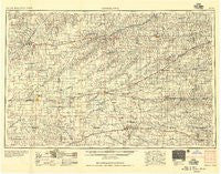
Goodland, Kansas, USGS topographic map dated 1957.
Includes geographic coordinates (latitude and longitude). This topographic map is suitable for hiking, camping, and exploring, or framing it as a wall map.
Printed on-demand using high resolution imagery, on heavy weight and acid free paper, or alternatively on a variety of synthetic materials.
Topos available on paper, Waterproof, Poly, or Tyvek. Usually shipping rolled, unless combined with other folded maps in one order.
- Product Number: USGS-5971186
- Free digital map download (high-resolution, GeoPDF): Goodland, Kansas (file size: 10 MB)
- Map Size: please refer to the dimensions of the GeoPDF map above
- Weight (paper map): ca. 55 grams
- Map Type: POD USGS Topographic Map
- Map Series: HTMC
- Map Verison: Historical
- Cell ID: 76863
- Scan ID: 801769
- Imprint Year: 1957
- Visual Version Number: 2
- Aerial Photo Year: 1953
- Field Check Year: 1954
- Datum: Unstated
- Map Projection: Transverse Mercator
- Map published by United States Army Corps of Engineers
- Map published by United States Army
- Map Language: English
- Scanner Resolution: 508 dpi
- Map Cell Name: Goodland
- Grid size: 1 X 2 Degree
- Date on map: 1957
- Map Scale: 1:250000
- Geographical region: Kansas, United States
Neighboring Maps:
All neighboring USGS topo maps are available for sale online at a variety of scales.
Spatial coverage:
Topo map Goodland, Kansas, covers the geographical area associated the following places:
- Reager - New Almelo - Colby - Kanona - Rockwell - Caruso - Saint Francis - Selden - Page City - Saint Peter - North Atwood - Grinnell - Rexford - Chardon - Achilles - Dresden - Friendly Acres Mobile Home Park - Monument - Breton - McAllaster - Brownville - Devizes - Allison - Menlo - Park - Oronoque - Brewster - Halford - Bird City - Levant - Lyle - Norcatur - Midway - Morland - Clayton - Patterson Mobile Home Park - Seguin - Dellvale - Angelus - Oberlin - Grainfield - Winona - Ludell - Herndon - McDonald - Edson - Blakeman - Mingo - Hoxie - Ruleton - Wheeler - Traer - Quinter - Oakley - Tasco - Jennings - Leoville - Cedar Bluffs - Collyer - Gem - Beardsley - Lenora - Goodland - Spica - Lucerne - Studley - Atwood - Voda
- Map Area ID: AREA4039-102-100
- Northwest corner Lat/Long code: USGSNW40-102
- Northeast corner Lat/Long code: USGSNE40-100
- Southwest corner Lat/Long code: USGSSW39-102
- Southeast corner Lat/Long code: USGSSE39-100
- Northern map edge Latitude: 40
- Southern map edge Latitude: 39
- Western map edge Longitude: -102
- Eastern map edge Longitude: -100


