
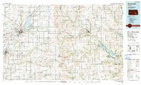
~ El Dorado KS topo map, 1:100000 scale, 30 X 60 Minute, Historical, 1990, updated 1990
El Dorado, Kansas, USGS topographic map dated 1990.
Includes geographic coordinates (latitude and longitude). This topographic map is suitable for hiking, camping, and exploring, or framing it as a wall map.
Printed on-demand using high resolution imagery, on heavy weight and acid free paper, or alternatively on a variety of synthetic materials.
Topos available on paper, Waterproof, Poly, or Tyvek. Usually shipping rolled, unless combined with other folded maps in one order.
- Product Number: USGS-5970746
- Free digital map download (high-resolution, GeoPDF): El Dorado, Kansas (file size: 17 MB)
- Map Size: please refer to the dimensions of the GeoPDF map above
- Weight (paper map): ca. 55 grams
- Map Type: POD USGS Topographic Map
- Map Series: HTMC
- Map Verison: Historical
- Cell ID: 67461
- Scan ID: 801587
- Imprint Year: 1990
- Woodland Tint: Yes
- Aerial Photo Year: 1986
- Edit Year: 1990
- Datum: NAD27
- Map Projection: Universal Transverse Mercator
- Map published by United States Geological Survey
- Map Language: English
- Scanner Resolution: 508 dpi
- Map Cell Name: El Dorado
- Grid size: 30 X 60 Minute
- Date on map: 1990
- Map Scale: 1:100000
- Geographical region: Kansas, United States
Neighboring Maps:
All neighboring USGS topo maps are available for sale online at a variety of scales.
Spatial coverage:
Topo map El Dorado, Kansas, covers the geographical area associated the following places:
- Mitchell Mobile Home Manor - Fall River - Climax - Hamilton - Leon - El Dorado - Latham - Beaumont - Pickrell Corner - Pontiac - Oak Ridge Mobile Home Community - Lapland - Prospect Mobile Home Park - East El Dorado - Reece - Summit - Highpoint Mobile Home Park - Augusta - Aikman - Clay Center - Vanora - Ivanpah - Towanda - Augusta Mobile Home Park - Keighley - Fiat - Rosalia - Severy - Sallyards - Waco Trailer Court - Leon Mobile Manor - Country Side Mobile Home Park - Landergin (historical) - Blodgett - Cave Springs - Belleview (historical) - Haverhill - Neal - Hanks Mobile Home Park - Tonovay - El Dorado Mobile Estates - Bois d' Arc - Smileyville - De Graff - Virgil - Gordon - Chelsea - Rocky Ford - Piedmont - Eureka - Utopia - Bloomington - Hopkins - Prospect - Midian
- Map Area ID: AREA3837.5-97-96
- Northwest corner Lat/Long code: USGSNW38-97
- Northeast corner Lat/Long code: USGSNE38-96
- Southwest corner Lat/Long code: USGSSW37.5-97
- Southeast corner Lat/Long code: USGSSE37.5-96
- Northern map edge Latitude: 38
- Southern map edge Latitude: 37.5
- Western map edge Longitude: -97
- Eastern map edge Longitude: -96


