
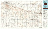
~ Dodge City KS topo map, 1:100000 scale, 30 X 60 Minute, Historical, 1985, updated 1988
Dodge City, Kansas, USGS topographic map dated 1985.
Includes geographic coordinates (latitude and longitude). This topographic map is suitable for hiking, camping, and exploring, or framing it as a wall map.
Printed on-demand using high resolution imagery, on heavy weight and acid free paper, or alternatively on a variety of synthetic materials.
Topos available on paper, Waterproof, Poly, or Tyvek. Usually shipping rolled, unless combined with other folded maps in one order.
- Product Number: USGS-5970608
- Free digital map download (high-resolution, GeoPDF): Dodge City, Kansas (file size: 14 MB)
- Map Size: please refer to the dimensions of the GeoPDF map above
- Weight (paper map): ca. 55 grams
- Map Type: POD USGS Topographic Map
- Map Series: HTMC
- Map Verison: Historical
- Cell ID: 67424
- Scan ID: 801584
- Imprint Year: 1988
- Woodland Tint: Yes
- Aerial Photo Year: 1981
- Edit Year: 1985
- Datum: NAD27
- Map Projection: Universal Transverse Mercator
- Map published by United States Geological Survey
- Map Language: English
- Scanner Resolution: 508 dpi
- Map Cell Name: Dodge City
- Grid size: 30 X 60 Minute
- Date on map: 1985
- Map Scale: 1:100000
- Geographical region: Kansas, United States
Neighboring Maps:
All neighboring USGS topo maps are available for sale online at a variety of scales.
Spatial coverage:
Topo map Dodge City, Kansas, covers the geographical area associated the following places:
- Haggard - Holcomb - Charleston - Sayre - Evergreen Trailer Court - Ingalls - Lazy Acres Trailer Park - Rancho Trailer Park - Montezuma - East Garden Mobile Home Village - Herron Mobile Home Park - Pierceville - Cimarron - Kingston Trailer Park - Countryside Estates Mobile Home Park - Eastside Trailer Park - Balls Trailer Park - Geier Trailer Park - Dodge City - Villa Manor Trailer Court - South Dodge - Sleepy Hollow Mobile Home Park - Sears - Tice - Acres West Mobile Home Park - Quinby - Westward Ho Mobile Home Park - Wagon Wheel Mobile Home Park - Prairie Wind Mobile Home Park - Mansfield - Meadow Lark Mobile Home Park - Prairie Village Trailer Court - Plymell - Howell - Kent's Trailer Park - Watersports Mobile Home Park - Westhaven Mobile Home Park - J and J Trailer Park - Countryside Manor Mobile Home Park - Camelot Trailer Park - Wettick - Ensign - Ponderosa Mobile Home Park - Copeland - Miller Trailer Park - Garden City
- Map Area ID: AREA3837.5-101-100
- Northwest corner Lat/Long code: USGSNW38-101
- Northeast corner Lat/Long code: USGSNE38-100
- Southwest corner Lat/Long code: USGSSW37.5-101
- Southeast corner Lat/Long code: USGSSE37.5-100
- Northern map edge Latitude: 38
- Southern map edge Latitude: 37.5
- Western map edge Longitude: -101
- Eastern map edge Longitude: -100


