
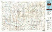
~ Concordia KS topo map, 1:100000 scale, 30 X 60 Minute, Historical, 1985, updated 1990
Concordia, Kansas, USGS topographic map dated 1985.
Includes geographic coordinates (latitude and longitude). This topographic map is suitable for hiking, camping, and exploring, or framing it as a wall map.
Printed on-demand using high resolution imagery, on heavy weight and acid free paper, or alternatively on a variety of synthetic materials.
Topos available on paper, Waterproof, Poly, or Tyvek. Usually shipping rolled, unless combined with other folded maps in one order.
- Product Number: USGS-5970432
- Free digital map download (high-resolution, GeoPDF): Concordia, Kansas (file size: 16 MB)
- Map Size: please refer to the dimensions of the GeoPDF map above
- Weight (paper map): ca. 55 grams
- Map Type: POD USGS Topographic Map
- Map Series: HTMC
- Map Verison: Historical
- Cell ID: 67327
- Scan ID: 801579
- Imprint Year: 1990
- Woodland Tint: Yes
- Photo Inspection Year: 1985
- Aerial Photo Year: 1981
- Edit Year: 1985
- Datum: NAD27
- Map Projection: Universal Transverse Mercator
- Map published by United States Geological Survey
- Map Language: English
- Scanner Resolution: 508 dpi
- Map Cell Name: Concordia
- Grid size: 30 X 60 Minute
- Date on map: 1985
- Map Scale: 1:100000
- Geographical region: Kansas, United States
Neighboring Maps:
All neighboring USGS topo maps are available for sale online at a variety of scales.
Spatial coverage:
Topo map Concordia, Kansas, covers the geographical area associated the following places:
- Morrowville - Narka - Harbine - Formoso - Washington - Rosaco - Enosdale - Haworth - Oscar (historical) - Concordia - Ames - Saint Joseph - Lovewell - Talmo - Wayne - Tabor - Rice - Palmer - Clyde - Huscher - Yuma - Clifton - Vining - Double J Mobile Home Park - Warwick - Kackley - Haddam - Cook - Scottsville - Belleville - Brantford - Cuba - Sherdahl - Calderhead - White Rock - Oneonta (historical) - Agenda - Lewis Mobile Home Park - Garfield Center - Norway - Strawberry - Linn - Mahaska - Munden - Republic - Courtland - Rydal - Scandia - Jamestown
- Map Area ID: AREA4039.5-98-97
- Northwest corner Lat/Long code: USGSNW40-98
- Northeast corner Lat/Long code: USGSNE40-97
- Southwest corner Lat/Long code: USGSSW39.5-98
- Southeast corner Lat/Long code: USGSSE39.5-97
- Northern map edge Latitude: 40
- Southern map edge Latitude: 39.5
- Western map edge Longitude: -98
- Eastern map edge Longitude: -97


