
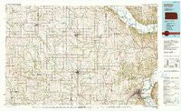
~ Atchison KS topo map, 1:100000 scale, 30 X 60 Minute, Historical, 1990, updated 1990
Atchison, Kansas, USGS topographic map dated 1990.
Includes geographic coordinates (latitude and longitude). This topographic map is suitable for hiking, camping, and exploring, or framing it as a wall map.
Printed on-demand using high resolution imagery, on heavy weight and acid free paper, or alternatively on a variety of synthetic materials.
Topos available on paper, Waterproof, Poly, or Tyvek. Usually shipping rolled, unless combined with other folded maps in one order.
- Product Number: USGS-5969754
- Free digital map download (high-resolution, GeoPDF): Atchison, Kansas (file size: 20 MB)
- Map Size: please refer to the dimensions of the GeoPDF map above
- Weight (paper map): ca. 55 grams
- Map Type: POD USGS Topographic Map
- Map Series: HTMC
- Map Verison: Historical
- Cell ID: 67074
- Scan ID: 801564
- Imprint Year: 1990
- Woodland Tint: Yes
- Aerial Photo Year: 1985
- Edit Year: 1990
- Datum: NAD27
- Map Projection: Universal Transverse Mercator
- Map published by United States Geological Survey
- Map Language: English
- Scanner Resolution: 508 dpi
- Map Cell Name: Atchison
- Grid size: 30 X 60 Minute
- Date on map: 1990
- Map Scale: 1:100000
- Geographical region: Kansas, United States
Neighboring Maps:
All neighboring USGS topo maps are available for sale online at a variety of scales.
Spatial coverage:
Topo map Atchison, Kansas, covers the geographical area associated the following places:
- Cowpoke Mobile Home Park - Fidelity - Winthrop - Doniphan - White Cloud - Brenner - Sparks - Wetmore - Moray - Oregon - Hiawatha - Good Intent - Forest City - Farmington - Netawaka - Bancroft - Woodlawn - Reserve - Berwick - Sun Springs - Fanning - Oneida - Purcell - Lancaster - Circleville - Sugar Lake - Kennekuk - Everest - Capioma - Parnell - Armour - Rushville - Mercier - Atchison - Hamlin - Blair - Baker - Granada - Goff - Troy - Iowa Point - Lewis and Clark Village - Horton - Powhattan - Bern - Willis - Highland - Sugar Lake - Curzon - Bendena - Denton - Effingham - Shannon - Robinson - Monrovia - Soldier - Sabetha - Leona - Severance - Muscotah - Whiting - Morrill - Huron - Lovelady Mobile Home Park - Richville - Fairview - Ontario - Forbes - Padonia
- Map Area ID: AREA4039.5-96-95
- Northwest corner Lat/Long code: USGSNW40-96
- Northeast corner Lat/Long code: USGSNE40-95
- Southwest corner Lat/Long code: USGSSW39.5-96
- Southeast corner Lat/Long code: USGSSE39.5-95
- Northern map edge Latitude: 40
- Southern map edge Latitude: 39.5
- Western map edge Longitude: -96
- Eastern map edge Longitude: -95


