
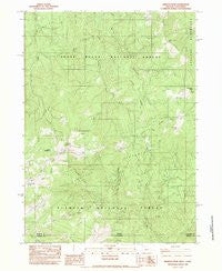
~ Siskiyou Peak OR topo map, 1:24000 scale, 7.5 X 7.5 Minute, Historical, 1983, updated 1983
Siskiyou Peak, Oregon, USGS topographic map dated 1983.
Includes geographic coordinates (latitude and longitude). This topographic map is suitable for hiking, camping, and exploring, or framing it as a wall map.
Printed on-demand using high resolution imagery, on heavy weight and acid free paper, or alternatively on a variety of synthetic materials.
Topos available on paper, Waterproof, Poly, or Tyvek. Usually shipping rolled, unless combined with other folded maps in one order.
- Product Number: USGS-5963674
- Free digital map download (high-resolution, GeoPDF): Siskiyou Peak, Oregon (file size: 17 MB)
- Map Size: please refer to the dimensions of the GeoPDF map above
- Weight (paper map): ca. 55 grams
- Map Type: POD USGS Topographic Map
- Map Series: HTMC
- Map Verison: Historical
- Cell ID: 41512
- Scan ID: 281527
- Imprint Year: 1983
- Woodland Tint: Yes
- Aerial Photo Year: 1976
- Edit Year: 1983
- Field Check Year: 1979
- Datum: NAD27
- Map Projection: Lambert Conformal Conic
- Provisional map: Yes
- Map published by United States Geological Survey
- Map Language: English
- Scanner Resolution: 600 dpi
- Map Cell Name: Siskiyou Peak
- Grid size: 7.5 X 7.5 Minute
- Date on map: 1983
- Map Scale: 1:24000
- Geographical region: Oregon, United States
Neighboring Maps:
All neighboring USGS topo maps are available for sale online at a variety of scales.
Spatial coverage:
Topo map Siskiyou Peak, Oregon, covers the geographical area associated the following places:
- Corral Creek - Doe Peak - Cinnabar Gap - Sevenmile Ridge - Cold Spring - Wagner Glade Gap - Little Red Mountain Creek - Sheep Creek - Jack Creek - Long John Creek - Siskiyou Peak - Hells Peak - Sheep Camp Spring - Greely Creek - Wymer Glade - Wagner Butte - Jim Creek - Wrangle Gap - Big Red Mountain Creek - Jack Flat - McDonald Peak - McDonald Ditch - West Branch Long John Creek - Big Red Mountain - Wrangle Creek - Freezeout Cabin - Hendricks Creek - Bear Gulch - McDonald Creek - Cinnabar Gulch - Lake Creek - North Fork Greely Creek - Center Ridge - Split Rock - Post Gulch - Wrangle Recreation Site - Garvin Gulch - Monogram Lakes - Siskiyou Gap - Split Rock Creek
- Map Area ID: AREA42.12542-122.875-122.75
- Northwest corner Lat/Long code: USGSNW42.125-122.875
- Northeast corner Lat/Long code: USGSNE42.125-122.75
- Southwest corner Lat/Long code: USGSSW42-122.875
- Southeast corner Lat/Long code: USGSSE42-122.75
- Northern map edge Latitude: 42.125
- Southern map edge Latitude: 42
- Western map edge Longitude: -122.875
- Eastern map edge Longitude: -122.75


