
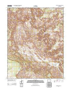
~ Anderson Mesa CO topo map, 1:24000 scale, 7.5 X 7.5 Minute, Historical, 2013
Anderson Mesa, Colorado, USGS topographic map dated 2013.
Includes geographic coordinates (latitude and longitude). This topographic map is suitable for hiking, camping, and exploring, or framing it as a wall map.
Printed on-demand using high resolution imagery, on heavy weight and acid free paper, or alternatively on a variety of synthetic materials.
Topos available on paper, Waterproof, Poly, or Tyvek. Usually shipping rolled, unless combined with other folded maps in one order.
- Product Number: USGS-5962711
- Free digital map download (high-resolution, GeoPDF): Anderson Mesa, Colorado (file size: 36 MB)
- Map Size: please refer to the dimensions of the GeoPDF map above
- Weight (paper map): ca. 55 grams
- Map Type: POD USGS Topographic Map
- Map Series: US Topo
- Map Verison: Historical
- Cell ID: 980
- Datum: North American Datum of 1983
- Map Projection: Transverse Mercator
- Map Cell Name: Anderson Mesa
- Grid size: 7.5 X 7.5 Minute
- Date on map: 2013
- Map Scale: 1:24000
- Geographical region: Colorado, United States
Neighboring Maps:
All neighboring USGS topo maps are available for sale online at a variety of scales.
Spatial coverage:
Topo map Anderson Mesa, Colorado, covers the geographical area associated the following places:
- Cabin Spring - Franklin Mine - Probable Mine - Edith Irene Mine - Big Medicine Mine - Joker Mine - Little Gypsum Creek - Muleshoe Bend - Radar Mine - Modeen Mine - Little Jewel Mine - Terrible Mine - Yorktown Mine - Spring Canyon - Buck Mesa - Navajo Mine - Andys Mesa - Muleshoe Bend Reservoir - East Island Mesa Spring - Morning Star Mine - Dolores River Arch - The Raven Mine - Grassy Hill Mine - Whiz Bang Mine - Happy Jack Mine - Terrible Brook Number One Mine - Expectant One Mine - Little Gypsum Valley - Gyp Mine - Silveys Pocket - Redbird Mine - Faultless Mine - Leach Creek - American Eagle Mine - Watchman Mine - Regis Mine - Skein Spring - Sky Lark Mine - Happy Joe Mine - Anderson Mesa - White Cow Mine - Canyon View Mine - Jumbo Mine - The Hat - Sunset Mine - Pooch Mine - Coyote Wash
- Map Area ID: AREA38.2538.125-109-108.875
- Northwest corner Lat/Long code: USGSNW38.25-109
- Northeast corner Lat/Long code: USGSNE38.25-108.875
- Southwest corner Lat/Long code: USGSSW38.125-109
- Southeast corner Lat/Long code: USGSSE38.125-108.875
- Northern map edge Latitude: 38.25
- Southern map edge Latitude: 38.125
- Western map edge Longitude: -109
- Eastern map edge Longitude: -108.875


