
~ West Beckwith Mountain CO topo map, 1:24000 scale, 7.5 X 7.5 Minute, Historical, 2013
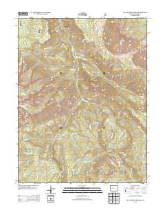
West Beckwith Mountain, Colorado, USGS topographic map dated 2013.
Includes geographic coordinates (latitude and longitude). This topographic map is suitable for hiking, camping, and exploring, or framing it as a wall map.
Printed on-demand using high resolution imagery, on heavy weight and acid free paper, or alternatively on a variety of synthetic materials.
Topos available on paper, Waterproof, Poly, or Tyvek. Usually shipping rolled, unless combined with other folded maps in one order.
- Product Number: USGS-5962639
- Free digital map download (high-resolution, GeoPDF): West Beckwith Mountain, Colorado (file size: 30 MB)
- Map Size: please refer to the dimensions of the GeoPDF map above
- Weight (paper map): ca. 55 grams
- Map Type: POD USGS Topographic Map
- Map Series: US Topo
- Map Verison: Historical
- Cell ID: 48137
- Datum: North American Datum of 1983
- Map Projection: Transverse Mercator
- Map Cell Name: West Beckwith Mountain
- Grid size: 7.5 X 7.5 Minute
- Date on map: 2013
- Map Scale: 1:24000
- Geographical region: Colorado, United States
Neighboring Maps:
All neighboring USGS topo maps are available for sale online at a variety of scales.
Spatial coverage:
Topo map West Beckwith Mountain, Colorado, covers the geographical area associated the following places:
- Kaufman Creek - Ranger Creek - Davenport Ranch - Cascade Creek - West Beckwith Mountain - Gunnison Lake - Little Gunnison Creek - Navajo Cabin - Sams Peak - Cliff Creek - Little Robinson Creek - Spruce Draw - Beaver Jungle - Coal Basin - Peter Creek - Cutler Creek - Navajo Gulch - Robinson Creek - Little Robinson Cow Camp - Snowshoe Mesa - Hammond Trail - Moseley Ridge - Coal Creek Mesa - Willow Creek - Wapiti Creek
- Map Area ID: AREA38.87538.75-107.375-107.25
- Northwest corner Lat/Long code: USGSNW38.875-107.375
- Northeast corner Lat/Long code: USGSNE38.875-107.25
- Southwest corner Lat/Long code: USGSSW38.75-107.375
- Southeast corner Lat/Long code: USGSSE38.75-107.25
- Northern map edge Latitude: 38.875
- Southern map edge Latitude: 38.75
- Western map edge Longitude: -107.375
- Eastern map edge Longitude: -107.25


