
~ Alice Lake MN topo map, 1:24000 scale, 7.5 X 7.5 Minute, Historical, 2013
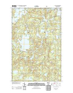
Alice Lake, Minnesota, USGS topographic map dated 2013.
Includes geographic coordinates (latitude and longitude). This topographic map is suitable for hiking, camping, and exploring, or framing it as a wall map.
Printed on-demand using high resolution imagery, on heavy weight and acid free paper, or alternatively on a variety of synthetic materials.
Topos available on paper, Waterproof, Poly, or Tyvek. Usually shipping rolled, unless combined with other folded maps in one order.
- Product Number: USGS-5959762
- Free digital map download (high-resolution, GeoPDF): Alice Lake, Minnesota (file size: 32 MB)
- Map Size: please refer to the dimensions of the GeoPDF map above
- Weight (paper map): ca. 55 grams
- Map Type: POD USGS Topographic Map
- Map Series: US Topo
- Map Verison: Historical
- Cell ID: 542
- Datum: North American Datum of 1983
- Map Projection: Transverse Mercator
- Map Cell Name: Alice Lake
- Grid size: 7.5 X 7.5 Minute
- Date on map: 2013
- Map Scale: 1:24000
- Geographical region: Minnesota, United States
Neighboring Maps:
All neighboring USGS topo maps are available for sale online at a variety of scales.
Spatial coverage:
Topo map Alice Lake, Minnesota, covers the geographical area associated the following places:
- Cacabic Lake - Hope Creek - Clevise Lake - Amber Lake - Bow Lake - Blissful Lake - Record Creek - Bugo Lake - Puffer Lake - Whiz Lake - Fishdance Lake - Maniwaki Lake - River Lake - Briar Lake - Club Lake - South Hope Lake - Record Lake - Alice Lake - Screamer Lake - Scotch Lake - Yoke Lake - Hum Lake - Douse Lake - Kaapoo Lake - Lake Carol - Thomas Lake - Turkey Lake - Caveman Lake - Jupiter Lake - Beaver Lake - Assawan Lake - Adams Lake - Treasure Lake - Fisher Lake - Smite Lake - Struggle Lake - Maniwaki Creek - Gogie Lake - Lethe Lake - Hope Lake
- Map Area ID: AREA4847.875-91.25-91.125
- Northwest corner Lat/Long code: USGSNW48-91.25
- Northeast corner Lat/Long code: USGSNE48-91.125
- Southwest corner Lat/Long code: USGSSW47.875-91.25
- Southeast corner Lat/Long code: USGSSE47.875-91.125
- Northern map edge Latitude: 48
- Southern map edge Latitude: 47.875
- Western map edge Longitude: -91.25
- Eastern map edge Longitude: -91.125


