
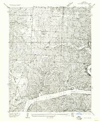
~ Schuyler MO topo map, 1:24000 scale, 7.5 X 7.5 Minute, Historical, 1957, updated 1957
Schuyler, Missouri, USGS topographic map dated 1957.
Includes geographic coordinates (latitude and longitude). This topographic map is suitable for hiking, camping, and exploring, or framing it as a wall map.
Printed on-demand using high resolution imagery, on heavy weight and acid free paper, or alternatively on a variety of synthetic materials.
Topos available on paper, Waterproof, Poly, or Tyvek. Usually shipping rolled, unless combined with other folded maps in one order.
- Product Number: USGS-5958087
- Free digital map download (high-resolution, GeoPDF): Schuyler, Missouri (file size: 12 MB)
- Map Size: please refer to the dimensions of the GeoPDF map above
- Weight (paper map): ca. 55 grams
- Map Type: POD USGS Topographic Map
- Map Series: HTMC
- Map Verison: Historical
- Cell ID: 25762
- Scan ID: 324076
- Imprint Year: 1957
- Survey Year: 1936
- Datum: NAD27
- Map Projection: Polyconic
- Advance: Yes
- Map published by United States Geological Survey
- Keywords: Nonstandard Press Run; Overedge
- Map Language: English
- Scanner Resolution: 600 dpi
- Map Cell Name: Lincoln SE
- Grid size: 7.5 X 7.5 Minute
- Date on map: 1957
- Map Scale: 1:24000
- Geographical region: Missouri, United States
Neighboring Maps:
All neighboring USGS topo maps are available for sale online at a variety of scales.
Spatial coverage:
Topo map Schuyler, Missouri, covers the geographical area associated the following places:
- Dillon School (historical) - Benton County - Sterett Creek - Poplar (historical) - Fredonia Church - Feaster Branch - Black Oak Cemetery - Bird Cemetery - Feaster Cemetery - Bird Branch - Warsaw Fire and Rescue Station 3 - Black Oak Church - Schuyler (historical) - McFarland School (historical) - Lemon Branch - Sterett Creek Public Use Area - Sterett Creek Dike - Victory in God Chapel - Short Cemetery - Warsaw Municipal Airport - Townes Hollow - Poplar School (historical) - KAYQ-FM (Warsaw) - Lincoln Lookout Tower - Fredonia School (historical) - Drake Cemetery - Horn Branch - Township of South Lindsey - Osage Valley Fire Protection District Station 2 - Mount Pleasant Cemetery - Negro Creek - Allen School (historical) - Feaster School - Vincent Cemetery - Mount Pleasant Church - McCalls Branch - Little Valley Hollow
- Map Area ID: AREA38.37538.25-93.375-93.25
- Northwest corner Lat/Long code: USGSNW38.375-93.375
- Northeast corner Lat/Long code: USGSNE38.375-93.25
- Southwest corner Lat/Long code: USGSSW38.25-93.375
- Southeast corner Lat/Long code: USGSSE38.25-93.25
- Northern map edge Latitude: 38.375
- Southern map edge Latitude: 38.25
- Western map edge Longitude: -93.375
- Eastern map edge Longitude: -93.25


