
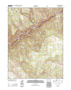
~ Shoshone CO topo map, 1:24000 scale, 7.5 X 7.5 Minute, Historical, 2013
Shoshone, Colorado, USGS topographic map dated 2013.
Includes geographic coordinates (latitude and longitude). This topographic map is suitable for hiking, camping, and exploring, or framing it as a wall map.
Printed on-demand using high resolution imagery, on heavy weight and acid free paper, or alternatively on a variety of synthetic materials.
Topos available on paper, Waterproof, Poly, or Tyvek. Usually shipping rolled, unless combined with other folded maps in one order.
- Product Number: USGS-5957229
- Free digital map download (high-resolution, GeoPDF): Shoshone, Colorado (file size: 30 MB)
- Map Size: please refer to the dimensions of the GeoPDF map above
- Weight (paper map): ca. 55 grams
- Map Type: POD USGS Topographic Map
- Map Series: US Topo
- Map Verison: Historical
- Cell ID: 41187
- Datum: North American Datum of 1983
- Map Projection: Transverse Mercator
- Map Cell Name: Shoshone
- Grid size: 7.5 X 7.5 Minute
- Date on map: 2013
- Map Scale: 1:24000
- Geographical region: Colorado, United States
Neighboring Maps:
All neighboring USGS topo maps are available for sale online at a variety of scales.
Spatial coverage:
Topo map Shoshone, Colorado, covers the geographical area associated the following places:
- Grizzly - Northwest Tank - Dry Gulch - Shoshone - Spruce Creek - Consolidated Dam - Hopkins Reservoir - Wagon Gulch - Hopkins Homestead - Consolidated Reservoir - Landis Creek - Devils Hole Canyon - Shoshone Powerplant - Tie Gulch - Hanging Lake Tunnels Fire Department - West Fork Dead Horse Creek - Last Tank - Ike Creek - Ralston Reservoir Number 1 - Dead Horse Creek - Shoshone Dam - Blue Gulch - Bridal Veil Falls - Bouller Tank - Dock Flats - Deadmans Gulch - Ralston Number 1 Dam - French Creek - Hopkins Dam - Higby - East Fork Dead Horse Creek - Green Lake - Bear Creek - Deadmans Creek - Grizzly Creek Picnic Ground - Hanging Lake Park - Devils Hole Creek - Allen - Hanging Lake - Cinnamon Creek
- Map Area ID: AREA39.62539.5-107.25-107.125
- Northwest corner Lat/Long code: USGSNW39.625-107.25
- Northeast corner Lat/Long code: USGSNE39.625-107.125
- Southwest corner Lat/Long code: USGSSW39.5-107.25
- Southeast corner Lat/Long code: USGSSE39.5-107.125
- Northern map edge Latitude: 39.625
- Southern map edge Latitude: 39.5
- Western map edge Longitude: -107.25
- Eastern map edge Longitude: -107.125


