
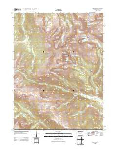
~ Trail Ridge CO topo map, 1:24000 scale, 7.5 X 7.5 Minute, Historical, 2013
Trail Ridge, Colorado, USGS topographic map dated 2013.
Includes geographic coordinates (latitude and longitude). This topographic map is suitable for hiking, camping, and exploring, or framing it as a wall map.
Printed on-demand using high resolution imagery, on heavy weight and acid free paper, or alternatively on a variety of synthetic materials.
Topos available on paper, Waterproof, Poly, or Tyvek. Usually shipping rolled, unless combined with other folded maps in one order.
- Product Number: USGS-5954781
- Free digital map download (high-resolution, GeoPDF): Trail Ridge, Colorado (file size: 27 MB)
- Map Size: please refer to the dimensions of the GeoPDF map above
- Weight (paper map): ca. 55 grams
- Map Type: POD USGS Topographic Map
- Map Series: US Topo
- Map Verison: Historical
- Cell ID: 45553
- Datum: North American Datum of 1983
- Map Projection: Transverse Mercator
- Map Cell Name: Trail Ridge
- Grid size: 7.5 X 7.5 Minute
- Date on map: 2013
- Map Scale: 1:24000
- Geographical region: Colorado, United States
Neighboring Maps:
All neighboring USGS topo maps are available for sale online at a variety of scales.
Spatial coverage:
Topo map Trail Ridge, Colorado, covers the geographical area associated the following places:
- Hagues Peak - Little Rock Lake - Sundance Mountain - Sundance Creek - Roaring River - Tombstone Ridge - Chiquita Lake - Iceberg Pass - Rainbow Curve - Hayden Creek - Chapin Creek - Chapin Pass - Rowe Peak - Bennett Creek - The Saddle - Hayden Gorge - Chasm Falls - Rock Cut - Rock Lake - Louis R Levings Grave - Marmot Point - Thousand Falls - Poudre River Trail - Chipmunk Lake - Spectacle Lakes - Trail Ridge - Ypsilon Mountain - Forest Lake - Desolation Peaks - Rowe Mountain - Lawn Lake - Hidden Valley Trail - Chapin Creek Trail - Hazeline Lake - Tundra Curves - Ypsilon Lake - Fay Lakes - Fairchild Mountain - Many Parks Curve - Lawn Lake Trail - Black Canyon Trail - Horseshoe Falls - Crystal Lake - Mount Chapin - Ypsilon Lake Trail - Rowe Glacier - Hanging Valley - Terra Tomah Mountain - Chiquita Creek - Lawn Dam - Endovalley Campground - Forest Canyon Overlook - Beaver Ponds Picnic Area - Willow Park - Timberline Pass - Little Crystal Lake - Mount Chiquita - Flatiron Mountain
- Map Area ID: AREA40.540.375-105.75-105.625
- Northwest corner Lat/Long code: USGSNW40.5-105.75
- Northeast corner Lat/Long code: USGSNE40.5-105.625
- Southwest corner Lat/Long code: USGSSW40.375-105.75
- Southeast corner Lat/Long code: USGSSE40.375-105.625
- Northern map edge Latitude: 40.5
- Southern map edge Latitude: 40.375
- Western map edge Longitude: -105.75
- Eastern map edge Longitude: -105.625


