
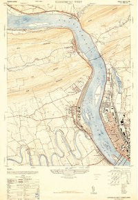
~ Harrisburg West PA topo map, 1:24000 scale, 7.5 X 7.5 Minute, Historical, 1947
Harrisburg West, Pennsylvania, USGS topographic map dated 1947.
Includes geographic coordinates (latitude and longitude). This topographic map is suitable for hiking, camping, and exploring, or framing it as a wall map.
Printed on-demand using high resolution imagery, on heavy weight and acid free paper, or alternatively on a variety of synthetic materials.
Topos available on paper, Waterproof, Poly, or Tyvek. Usually shipping rolled, unless combined with other folded maps in one order.
- Product Number: USGS-5953037
- Free digital map download (high-resolution, GeoPDF): Harrisburg West, Pennsylvania (file size: 13 MB)
- Map Size: please refer to the dimensions of the GeoPDF map above
- Weight (paper map): ca. 55 grams
- Map Type: POD USGS Topographic Map
- Map Series: HTMC
- Map Verison: Historical
- Cell ID: 19455
- Scan ID: 8032290
- Visual Version Number: 1
- Aerial Photo Year: 1946
- Datum: NAD27
- Map Projection: Transverse Mercator
- Map published by United States Army Corps of Engineers
- Map published by United States Army
- Map published by United States Department of War
- Map Language: English
- Scanner Resolution: 600 dpi
- Map Cell Name: Harrisburg West
- Grid size: 7.5 X 7.5 Minute
- Date on map: 1947
- Map Scale: 1:24000
- Geographical region: Pennsylvania, United States
Neighboring Maps:
All neighboring USGS topo maps are available for sale online at a variety of scales.
Spatial coverage:
Topo map Harrisburg West, Pennsylvania, covers the geographical area associated the following places:
- West Enola - Harrisburg - Grandview Acres - Kingwood - Montrose Park - Mount Zion - Coxtown (historical) - Rockville - Good Hope - Summerdale - Marysville - Hampden Village Mobile Home Park - Knob Point - Westwood Village - West Fairview - Mount View - Heckton - Ridgeland - Overview - Mountain Dale - Enola - Mountain View Estates - Dauphin - Fort Hunter - Glenvale - Jackson Lick - West Creek Hills - Good Hope Mill - Coventry Close - Cove - Windsor Farms - Treemont - Perdix - Wormleysburg - Lucknow - Fox Ridge Court - Sherwood Park - Beaufort Farms - Hillside Village - Speeceville
- Map Area ID: AREA40.37540.25-77-76.875
- Northwest corner Lat/Long code: USGSNW40.375-77
- Northeast corner Lat/Long code: USGSNE40.375-76.875
- Southwest corner Lat/Long code: USGSSW40.25-77
- Southeast corner Lat/Long code: USGSSE40.25-76.875
- Northern map edge Latitude: 40.375
- Southern map edge Latitude: 40.25
- Western map edge Longitude: -77
- Eastern map edge Longitude: -76.875


