
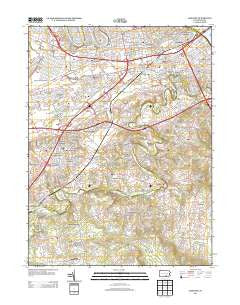
~ Lemoyne PA topo map, 1:24000 scale, 7.5 X 7.5 Minute, Historical, 2013
Lemoyne, Pennsylvania, USGS topographic map dated 2013.
Includes geographic coordinates (latitude and longitude). This topographic map is suitable for hiking, camping, and exploring, or framing it as a wall map.
Printed on-demand using high resolution imagery, on heavy weight and acid free paper, or alternatively on a variety of synthetic materials.
Topos available on paper, Waterproof, Poly, or Tyvek. Usually shipping rolled, unless combined with other folded maps in one order.
- Product Number: USGS-5951167
- Free digital map download (high-resolution, GeoPDF): Lemoyne, Pennsylvania (file size: 29 MB)
- Map Size: please refer to the dimensions of the GeoPDF map above
- Weight (paper map): ca. 55 grams
- Map Type: POD USGS Topographic Map
- Map Series: US Topo
- Map Verison: Historical
- Cell ID: 25414
- Datum: North American Datum of 1983
- Map Projection: Transverse Mercator
- Map Cell Name: Lemoyne
- Grid size: 7.5 X 7.5 Minute
- Date on map: 2013
- Map Scale: 1:24000
- Geographical region: Pennsylvania, United States
Neighboring Maps:
All neighboring USGS topo maps are available for sale online at a variety of scales.
Spatial coverage:
Topo map Lemoyne, Pennsylvania, covers the geographical area associated the following places:
- Limekiln Acres - Cedar Point - Winding Heights - Rossmoyne - Cedar Cliff - Raven Hill - Winding Hill - New Cumberland - Nauvoo - Green Lane Farms - Shiremanstown - Mount Allen Estates - Fort Couch - Washington Heights - Orchard Terrace - Nantilly - Waseka Acres - Shepherdstown - Windsor Park - Bunches - Timber Ridge - Howell - Nauvoo Estates - Kimberly Meadows - Holliday - Sporting Hill - Mount Allen - Highland Park - Allendale - Lower Allen - Bowmansdale - Memphord Estates - Andersontown - Drexel Hills - Reservoir Hill - Flintlock Ridge - White Hill - Allenview - Peace Church - Rossmoyne Manor - Lisburn - Grantham - Mount Pleasant - Lemoyne - Orchard Crest - Fair Acres - Oakwood Park - Meadowbrook Mobile Home Park - Spring Run Acres - Camp Hill - Eberlys Mill - Spring Run Manor - Siddonsburg
- Map Area ID: AREA40.2540.125-77-76.875
- Northwest corner Lat/Long code: USGSNW40.25-77
- Northeast corner Lat/Long code: USGSNE40.25-76.875
- Southwest corner Lat/Long code: USGSSW40.125-77
- Southeast corner Lat/Long code: USGSSE40.125-76.875
- Northern map edge Latitude: 40.25
- Southern map edge Latitude: 40.125
- Western map edge Longitude: -77
- Eastern map edge Longitude: -76.875


