
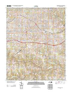
~ Burlington NC topo map, 1:24000 scale, 7.5 X 7.5 Minute, Historical, 2013
Burlington, North Carolina, USGS topographic map dated 2013.
Includes geographic coordinates (latitude and longitude). This topographic map is suitable for hiking, camping, and exploring, or framing it as a wall map.
Printed on-demand using high resolution imagery, on heavy weight and acid free paper, or alternatively on a variety of synthetic materials.
Topos available on paper, Waterproof, Poly, or Tyvek. Usually shipping rolled, unless combined with other folded maps in one order.
- Product Number: USGS-5948273
- Free digital map download (high-resolution, GeoPDF): Burlington, North Carolina (file size: 38 MB)
- Map Size: please refer to the dimensions of the GeoPDF map above
- Weight (paper map): ca. 55 grams
- Map Type: POD USGS Topographic Map
- Map Series: US Topo
- Map Verison: Historical
- Cell ID: 6266
- Datum: North American Datum of 1983
- Map Projection: Transverse Mercator
- Map Cell Name: Burlington
- Grid size: 7.5 X 7.5 Minute
- Date on map: 2013
- Map Scale: 1:24000
- Geographical region: North Carolina, United States
Neighboring Maps:
All neighboring USGS topo maps are available for sale online at a variety of scales.
Spatial coverage:
Topo map Burlington, North Carolina, covers the geographical area associated the following places:
- Graber Heights - Quail Hollow - Jackson Park - Alamance Acres - Beverly Hills - Longview Acres - Greenbrier - Forest Hills - The Farm - Country Club Estates - Glen Raven - Spring Valley - Knollwood - Alamance Hills Subdivision - Lee Acres - Forest Valley Mobile Home Subdivision - Kellam Place - Sunset Acres - Maple Grove Acres - Alamance - Country Club Forest - Wedgewood West - Dogwood Acres - Martindale Acres - Avalon Valley - Rockwood - Central Heights - Broad Acres - Red Oak Acres - Turrentine Estates - Westerwood - Hunting Hills - Graham - Morgantown - Lakeside - Woodshire Estates - Bellemont - Piedmont Heights - Overland Heights - Pinewood Acres - Pinewood Forest - Crestwood - Hopedale - Sherwood Forest - Fairchild Heights Subdivision - Brookwood Subdivision - Rockwood Acres - Grove Park - Pickwood Hills - Northwood - Burlington - Cedar Crest
- Map Area ID: AREA36.12536-79.5-79.375
- Northwest corner Lat/Long code: USGSNW36.125-79.5
- Northeast corner Lat/Long code: USGSNE36.125-79.375
- Southwest corner Lat/Long code: USGSSW36-79.5
- Southeast corner Lat/Long code: USGSSE36-79.375
- Northern map edge Latitude: 36.125
- Southern map edge Latitude: 36
- Western map edge Longitude: -79.5
- Eastern map edge Longitude: -79.375


