
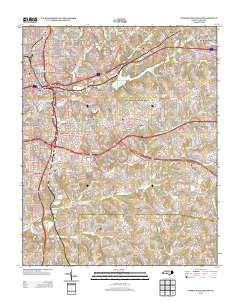
~ Winston Salem East NC topo map, 1:24000 scale, 7.5 X 7.5 Minute, Historical, 2013
Winston Salem East, North Carolina, USGS topographic map dated 2013.
Includes geographic coordinates (latitude and longitude). This topographic map is suitable for hiking, camping, and exploring, or framing it as a wall map.
Printed on-demand using high resolution imagery, on heavy weight and acid free paper, or alternatively on a variety of synthetic materials.
Topos available on paper, Waterproof, Poly, or Tyvek. Usually shipping rolled, unless combined with other folded maps in one order.
- Product Number: USGS-5947745
- Free digital map download (high-resolution, GeoPDF): Winston Salem East, North Carolina (file size: 36 MB)
- Map Size: please refer to the dimensions of the GeoPDF map above
- Weight (paper map): ca. 55 grams
- Map Type: POD USGS Topographic Map
- Map Series: US Topo
- Map Verison: Historical
- Cell ID: 49541
- Datum: North American Datum of 1983
- Map Projection: Transverse Mercator
- Map Cell Name: Winston-Salem East
- Grid size: 7.5 X 7.5 Minute
- Date on map: 2013
- Map Scale: 1:24000
- Geographical region: North Carolina, United States
Neighboring Maps:
All neighboring USGS topo maps are available for sale online at a variety of scales.
Spatial coverage:
Topo map Winston Salem East, North Carolina, covers the geographical area associated the following places:
- Merriweather Estates - South Side - Guthrie - Union Ridge - Rolling Acres - Cityview - Holly Acres - Salem - Rosemont - Wallburg - Sedge Garden - Waughtown - Easton View - Winston-Salem - Columbia Heights - Glen High Estates - Sunnyside - Willowbend - North Winston - Morningside Manor - Shalimar - Skyview Park - East Winston - Four Seasons - Woodbridge - Park Terrace - Arcadia
- Map Area ID: AREA36.12536-80.25-80.125
- Northwest corner Lat/Long code: USGSNW36.125-80.25
- Northeast corner Lat/Long code: USGSNE36.125-80.125
- Southwest corner Lat/Long code: USGSSW36-80.25
- Southeast corner Lat/Long code: USGSSE36-80.125
- Northern map edge Latitude: 36.125
- Southern map edge Latitude: 36
- Western map edge Longitude: -80.25
- Eastern map edge Longitude: -80.125


