
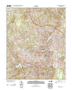
~ Chapel Hill NC topo map, 1:24000 scale, 7.5 X 7.5 Minute, Historical, 2013
Chapel Hill, North Carolina, USGS topographic map dated 2013.
Includes geographic coordinates (latitude and longitude). This topographic map is suitable for hiking, camping, and exploring, or framing it as a wall map.
Printed on-demand using high resolution imagery, on heavy weight and acid free paper, or alternatively on a variety of synthetic materials.
Topos available on paper, Waterproof, Poly, or Tyvek. Usually shipping rolled, unless combined with other folded maps in one order.
- Product Number: USGS-5945507
- Free digital map download (high-resolution, GeoPDF): Chapel Hill, North Carolina (file size: 40 MB)
- Map Size: please refer to the dimensions of the GeoPDF map above
- Weight (paper map): ca. 55 grams
- Map Type: POD USGS Topographic Map
- Map Series: US Topo
- Map Verison: Historical
- Cell ID: 8148
- Datum: North American Datum of 1983
- Map Projection: Transverse Mercator
- Map Cell Name: Chapel Hill
- Grid size: 7.5 X 7.5 Minute
- Date on map: 2013
- Map Scale: 1:24000
- Geographical region: North Carolina, United States
Neighboring Maps:
All neighboring USGS topo maps are available for sale online at a variety of scales.
Spatial coverage:
Topo map Chapel Hill, North Carolina, covers the geographical area associated the following places:
- Davie Circle - Eubanks - Kensington Trace - Pine Knob - Greenwood - Coker Hills - Birchwood Lake Estates - Northwood - The Oaks - Timbercrest - Lakewoods - Lake Forest Estates - Morgan Creek Hills - Timberlyne - Dogwood Acres - Lake Ellen - Quail Run - Spring Valley - Hidden Hills - Rangewood - Chapel Hill - Manor Hill - Tenney Circle - Clark Hills - The Oaks II - Laurel Springs - Elkins Hills - Colonial Heights - Oak Hills - Carlton Acres - Carrboro - Coventry - Stoneridge - Ridgefield - Ridgefield Park - High Park - Wildwood Springs - Calvander - Stoney Brook - Carolwoods - Barrington Hills - Sedgefield - Eastowne - Ironwoods - Fox Meadows - Estates Hills - Briarcliff - The Woods at Laurel Hill - Ashley Forest - The Meadows - Robins Wood - Colony Park - Plantation Acres - Blackwood - The Highlands - Cedar Hill - Glen Heights - Summerfield Crossing - Glen Lennox - Southbridge - Mount Bolus - North Forest Hills - Weatherhill - Colony Woods - Farrington Hills
- Map Area ID: AREA3635.875-79.125-79
- Northwest corner Lat/Long code: USGSNW36-79.125
- Northeast corner Lat/Long code: USGSNE36-79
- Southwest corner Lat/Long code: USGSSW35.875-79.125
- Southeast corner Lat/Long code: USGSSE35.875-79
- Northern map edge Latitude: 36
- Southern map edge Latitude: 35.875
- Western map edge Longitude: -79.125
- Eastern map edge Longitude: -79


