
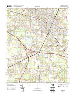
~ Wilson NC topo map, 1:24000 scale, 7.5 X 7.5 Minute, Historical, 2013
Wilson, North Carolina, USGS topographic map dated 2013.
Includes geographic coordinates (latitude and longitude). This topographic map is suitable for hiking, camping, and exploring, or framing it as a wall map.
Printed on-demand using high resolution imagery, on heavy weight and acid free paper, or alternatively on a variety of synthetic materials.
Topos available on paper, Waterproof, Poly, or Tyvek. Usually shipping rolled, unless combined with other folded maps in one order.
- Product Number: USGS-5944998
- Free digital map download (high-resolution, GeoPDF): Wilson, North Carolina (file size: 29 MB)
- Map Size: please refer to the dimensions of the GeoPDF map above
- Weight (paper map): ca. 55 grams
- Map Type: POD USGS Topographic Map
- Map Series: US Topo
- Map Verison: Historical
- Cell ID: 49320
- Datum: North American Datum of 1983
- Map Projection: Transverse Mercator
- Map Cell Name: Wilson
- Grid size: 7.5 X 7.5 Minute
- Date on map: 2013
- Map Scale: 1:24000
- Geographical region: North Carolina, United States
Neighboring Maps:
All neighboring USGS topo maps are available for sale online at a variety of scales.
Spatial coverage:
Topo map Wilson, North Carolina, covers the geographical area associated the following places:
- Quail Hollow - Valleydale Estates - Pinewood Estates - Crestview - Sandy Creek - Seven Hills - Forest Hills - Jennings Acres - Imperial Estates - Quail Ridge - Forrest Road Homes - Farrior Park - Glenwood Hills - Wiggins Mill - Contentnea Junction - Bel-Air Forest - Lincoln Heights - Waterford - Oakforest - Farmington Heights - Cavalier Park - Black Creek - Whitfield Homes - Brookside Manor - Breckenridge - Wilco Manor Mobile Home Park - Cavalier Terrace - Dixie - Wildwood - Boswellville - Montclair - Woodfield - Five Points - British Woods - Belle Meade - Westwood - Hominy Heights - Millbrook - Edgewood - Wilson - Washington Place
- Map Area ID: AREA35.7535.625-78-77.875
- Northwest corner Lat/Long code: USGSNW35.75-78
- Northeast corner Lat/Long code: USGSNE35.75-77.875
- Southwest corner Lat/Long code: USGSSW35.625-78
- Southeast corner Lat/Long code: USGSSE35.625-77.875
- Northern map edge Latitude: 35.75
- Southern map edge Latitude: 35.625
- Western map edge Longitude: -78
- Eastern map edge Longitude: -77.875


